You are here: Home > Network List > CI - Caltech Regional Seismic Network Stations List
> Station MPM Manuel Prospect Mine, California, USA > Earthquake Result Viewer
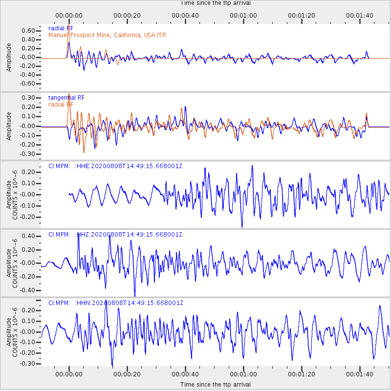
MPM Manuel Prospect Mine, California, USA - Earthquake Result Viewer
*The percent match for this event was below the threshold and hence no stack was calculated.
| Earthquake location: |
Alaska Peninsula |
| Earthquake latitude/longitude: |
54.8/-161.3 |
| Earthquake time(UTC): |
2020/08/08 (221) 14:42:55 GMT |
| Earthquake Depth: |
42 km |
| Earthquake Magnitude: |
5.5 mww |
| Earthquake Catalog/Contributor: |
NEIC PDE/us |
|
| Network: |
CI Caltech Regional Seismic Network |
| Station: |
MPM Manuel Prospect Mine, California, USA |
| Lat/Lon: |
36.06 N/117.49 W |
| Elevation: |
185 m |
|
| Distance: |
35.3 deg |
| Az: |
103.803 deg |
| Baz: |
316.056 deg |
| Ray Param: |
$rayparam |
*The percent match for this event was below the threshold and hence was not used in the summary stack. |
|
| Radial Match: |
58.146214 % |
| Radial Bump: |
400 |
| Transverse Match: |
53.442863 % |
| Transverse Bump: |
400 |
| SOD ConfigId: |
21709731 |
| Insert Time: |
2020-08-22 14:46:39.286 +0000 |
| GWidth: |
2.5 |
| Max Bumps: |
400 |
| Tol: |
0.001 |
|
Signal To Noise
| Channel | StoN | STA | LTA |
| CI:MPM: :HHZ:20200808T14:49:15.668001Z | 1.6066134 | 1.3059704E-7 | 8.128716E-8 |
| CI:MPM: :HHN:20200808T14:49:15.668001Z | 1.3988103 | 7.577177E-8 | 5.4168726E-8 |
| CI:MPM: :HHE:20200808T14:49:15.668001Z | 1.1526297 | 5.5290936E-8 | 4.7969383E-8 |
| Arrivals |
| Ps | |
| PpPs | |
| PsPs/PpSs | |


