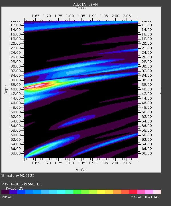
CTA Charters Towers, Queensland - Earthquake Result Viewer

Earthquake location: Bonin Islands, Japan Region
Earthquake latitude/longitude: 26.8/142.4
Earthquake time(UTC): 2008/02/27 (058) 06:54:20 GMT
Earthquake Depth: 15 km
Earthquake Magnitude: 5.8 MB, 6.1 MS, 6.2 MW, 6.2 MW
Earthquake Catalog/Contributor: WHDF/NEIC
Network: AU Australian Seismological Centre
Station: CTA Charters Towers, Queensland
Lat/Lon: 20.09 S/146.25 E
Elevation: 426 m
Distance: 46.8 deg
Az: 175.08 deg
Baz: 355.323 deg
Ray Param: 0.0704204
Estimated Moho Depth: 38.5 km
Estimated Crust Vp/Vs: 1.64
Assumed Crust Vp: 6.522 km/s
Estimated Crust Vs: 3.971 km/s
Estimated Crust Poisson's Ratio: 0.21
Radial Match: 90.9122 %
Radial Bump: 297
Transverse Match: 63.96298 %
Transverse Bump: 400
SOD ConfigId: 2564
Insert Time: 2010-03-08 23:47:43.760 +0000
GWidth: 2.5
Max Bumps: 400
Tol: 0.001

Signal To Noise

ChannelStoNSTALTA
AU:CTA: :BHN:20080227T07:02:18.349014Z1.97263413.1708677E-71.6074283E-7
AU:CTA: :BHE:20080227T07:02:18.349014Z0.69723021.2551628E-71.8002129E-7
AU:CTA: :BHZ:20080227T07:02:18.349014Z4.64306457.2226703E-71.5555825E-7
Arrivals
Ps4.1 SECOND
PpPs15 SECOND
PsPs/PpSs19 SECOND