You are here: Home > Network List > UU - University of Utah Regional Network Stations List
> Station FORU South Mineral Mountains, UT, USA > Earthquake Result Viewer
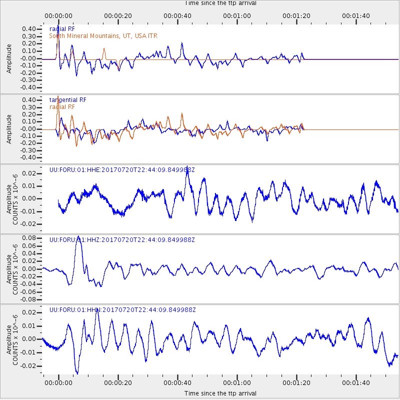
FORU South Mineral Mountains, UT, USA - Earthquake Result Viewer
*The percent match for this event was below the threshold and hence no stack was calculated.
| Earthquake location: |
Dodecanese Islands, Greece |
| Earthquake latitude/longitude: |
36.9/27.5 |
| Earthquake time(UTC): |
2017/07/20 (201) 22:31:12 GMT |
| Earthquake Depth: |
10 km |
| Earthquake Magnitude: |
6.7 Mww |
| Earthquake Catalog/Contributor: |
NEIC PDE/us |
|
| Network: |
UU University of Utah Regional Network |
| Station: |
FORU South Mineral Mountains, UT, USA |
| Lat/Lon: |
38.46 N/112.86 W |
| Elevation: |
1840 m |
|
| Distance: |
96.5 deg |
| Az: |
329.699 deg |
| Baz: |
30.986 deg |
| Ray Param: |
$rayparam |
*The percent match for this event was below the threshold and hence was not used in the summary stack. |
|
| Radial Match: |
69.00672 % |
| Radial Bump: |
400 |
| Transverse Match: |
55.386494 % |
| Transverse Bump: |
395 |
| SOD ConfigId: |
2140511 |
| Insert Time: |
2017-08-03 14:45:25.008 +0000 |
| GWidth: |
2.5 |
| Max Bumps: |
400 |
| Tol: |
0.001 |
|
Signal To Noise
| Channel | StoN | STA | LTA |
| UU:FORU:01:HHZ:20170720T22:44:09.849988Z | 8.555198 | 1.9925382E-8 | 2.3290383E-9 |
| UU:FORU:01:HHN:20170720T22:44:09.849988Z | 1.645427 | 6.24695E-9 | 3.7965524E-9 |
| UU:FORU:01:HHE:20170720T22:44:09.849988Z | 0.7848474 | 5.0357536E-9 | 6.41622E-9 |
| Arrivals |
| Ps | |
| PpPs | |
| PsPs/PpSs | |


