You are here: Home > Network List > US - United States National Seismic Network Stations List
> Station ERPA Erie, Pennsylvania, USA > Earthquake Result Viewer
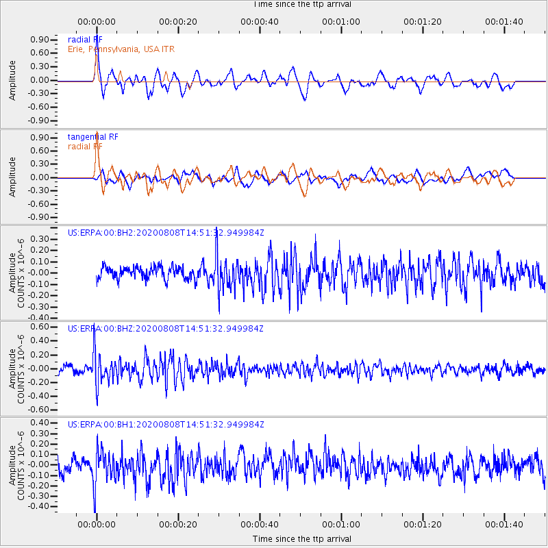
ERPA Erie, Pennsylvania, USA - Earthquake Result Viewer
*The percent match for this event was below the threshold and hence no stack was calculated.
| Earthquake location: |
Alaska Peninsula |
| Earthquake latitude/longitude: |
54.8/-161.3 |
| Earthquake time(UTC): |
2020/08/08 (221) 14:42:55 GMT |
| Earthquake Depth: |
42 km |
| Earthquake Magnitude: |
5.5 mww |
| Earthquake Catalog/Contributor: |
NEIC PDE/us |
|
| Network: |
US United States National Seismic Network |
| Station: |
ERPA Erie, Pennsylvania, USA |
| Lat/Lon: |
42.12 N/79.99 W |
| Elevation: |
306 m |
|
| Distance: |
52.4 deg |
| Az: |
68.152 deg |
| Baz: |
313.751 deg |
| Ray Param: |
$rayparam |
*The percent match for this event was below the threshold and hence was not used in the summary stack. |
|
| Radial Match: |
64.11758 % |
| Radial Bump: |
400 |
| Transverse Match: |
55.233727 % |
| Transverse Bump: |
400 |
| SOD ConfigId: |
21709731 |
| Insert Time: |
2020-08-22 15:04:49.688 +0000 |
| GWidth: |
2.5 |
| Max Bumps: |
400 |
| Tol: |
0.001 |
|
Signal To Noise
| Channel | StoN | STA | LTA |
| US:ERPA:00:BHZ:20200808T14:51:32.949984Z | 4.7114053 | 2.3331395E-7 | 4.95211E-8 |
| US:ERPA:00:BH1:20200808T14:51:32.949984Z | 2.6920614 | 1.6416419E-7 | 6.0980845E-8 |
| US:ERPA:00:BH2:20200808T14:51:32.949984Z | 3.016065 | 1.5661858E-7 | 5.192812E-8 |
| Arrivals |
| Ps | |
| PpPs | |
| PsPs/PpSs | |


