You are here: Home > Network List > US - United States National Seismic Network Stations List
> Station WUAZ Wupatki, Arizona, USA > Earthquake Result Viewer
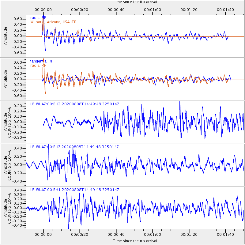
WUAZ Wupatki, Arizona, USA - Earthquake Result Viewer
*The percent match for this event was below the threshold and hence no stack was calculated.
| Earthquake location: |
Alaska Peninsula |
| Earthquake latitude/longitude: |
54.8/-161.3 |
| Earthquake time(UTC): |
2020/08/08 (221) 14:42:55 GMT |
| Earthquake Depth: |
42 km |
| Earthquake Magnitude: |
5.5 mww |
| Earthquake Catalog/Contributor: |
NEIC PDE/us |
|
| Network: |
US United States National Seismic Network |
| Station: |
WUAZ Wupatki, Arizona, USA |
| Lat/Lon: |
35.52 N/111.37 W |
| Elevation: |
1592 m |
|
| Distance: |
39.1 deg |
| Az: |
98.535 deg |
| Baz: |
315.419 deg |
| Ray Param: |
$rayparam |
*The percent match for this event was below the threshold and hence was not used in the summary stack. |
|
| Radial Match: |
77.35763 % |
| Radial Bump: |
400 |
| Transverse Match: |
66.6511 % |
| Transverse Bump: |
400 |
| SOD ConfigId: |
21709731 |
| Insert Time: |
2020-08-22 15:05:19.027 +0000 |
| GWidth: |
2.5 |
| Max Bumps: |
400 |
| Tol: |
0.001 |
|
Signal To Noise
| Channel | StoN | STA | LTA |
| US:WUAZ:00:BHZ:20200808T14:49:48.325014Z | 3.072338 | 1.5245534E-7 | 4.9621924E-8 |
| US:WUAZ:00:BH1:20200808T14:49:48.325014Z | 1.960227 | 9.676191E-8 | 4.9362605E-8 |
| US:WUAZ:00:BH2:20200808T14:49:48.325014Z | 1.8634531 | 9.415145E-8 | 5.052526E-8 |
| Arrivals |
| Ps | |
| PpPs | |
| PsPs/PpSs | |


