You are here: Home > Network List > TA - USArray Transportable Network (new EarthScope stations) Stations List
> Station F21K Alatna River, AK, USA > Earthquake Result Viewer
F21K Alatna River, AK, USA - Earthquake Result Viewer
*The percent match for this event was below the threshold and hence no stack was calculated.
| Earthquake location: |
North Carolina |
| Earthquake latitude/longitude: |
36.5/-81.1 |
| Earthquake time(UTC): |
2020/08/09 (222) 12:07:37 GMT |
| Earthquake Depth: |
5.0 km |
| Earthquake Magnitude: |
5.1 Mww |
| Earthquake Catalog/Contributor: |
NEIC PDE/us |
|
| Network: |
TA USArray Transportable Network (new EarthScope stations) |
| Station: |
F21K Alatna River, AK, USA |
| Lat/Lon: |
67.22 N/153.48 W |
| Elevation: |
597 m |
|
| Distance: |
50.2 deg |
| Az: |
331.11 deg |
| Baz: |
89.569 deg |
| Ray Param: |
$rayparam |
*The percent match for this event was below the threshold and hence was not used in the summary stack. |
|
| Radial Match: |
61.15789 % |
| Radial Bump: |
400 |
| Transverse Match: |
40.853664 % |
| Transverse Bump: |
400 |
| SOD ConfigId: |
21709731 |
| Insert Time: |
2020-08-23 12:20:05.413 +0000 |
| GWidth: |
2.5 |
| Max Bumps: |
400 |
| Tol: |
0.001 |
|
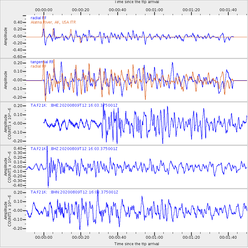
Signal To Noise
| Channel | StoN | STA | LTA |
| TA:F21K: :BHZ:20200809T12:16:03.375001Z | 3.57223 | 1.7687319E-7 | 4.951338E-8 |
| TA:F21K: :BHN:20200809T12:16:03.375001Z | 1.0877013 | 4.6307793E-8 | 4.2573998E-8 |
| TA:F21K: :BHE:20200809T12:16:03.375001Z | 3.1533806 | 9.849723E-8 | 3.123544E-8 |
| Arrivals |
| Ps | |
| PpPs | |
| PsPs/PpSs | |


