You are here: Home > Network List > IU - Global Seismograph Network (GSN - IRIS/USGS) Stations List
> Station MAKZ Makanchi, Kazakhstan > Earthquake Result Viewer
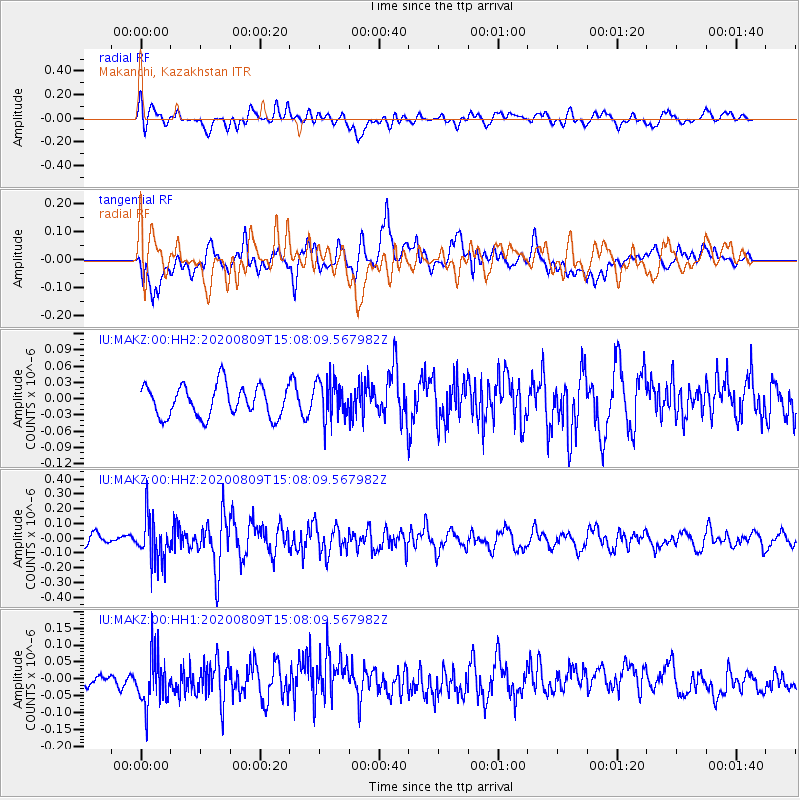
MAKZ Makanchi, Kazakhstan - Earthquake Result Viewer
*The percent match for this event was below the threshold and hence no stack was calculated.
| Earthquake location: |
Alaska Peninsula |
| Earthquake latitude/longitude: |
56.0/-158.8 |
| Earthquake time(UTC): |
2020/08/09 (222) 14:58:00 GMT |
| Earthquake Depth: |
37 km |
| Earthquake Magnitude: |
5.7 ml |
| Earthquake Catalog/Contributor: |
NEIC PDE/ak |
|
| Network: |
IU Global Seismograph Network (GSN - IRIS/USGS) |
| Station: |
MAKZ Makanchi, Kazakhstan |
| Lat/Lon: |
46.81 N/81.98 E |
| Elevation: |
600 m |
|
| Distance: |
65.6 deg |
| Az: |
318.827 deg |
| Baz: |
32.591 deg |
| Ray Param: |
$rayparam |
*The percent match for this event was below the threshold and hence was not used in the summary stack. |
|
| Radial Match: |
56.979618 % |
| Radial Bump: |
400 |
| Transverse Match: |
71.16657 % |
| Transverse Bump: |
400 |
| SOD ConfigId: |
21709731 |
| Insert Time: |
2020-08-23 15:06:24.174 +0000 |
| GWidth: |
2.5 |
| Max Bumps: |
400 |
| Tol: |
0.001 |
|
Signal To Noise
| Channel | StoN | STA | LTA |
| IU:MAKZ:00:HHZ:20200809T15:08:09.567982Z | 2.8606036 | 1.52289E-7 | 5.323667E-8 |
| IU:MAKZ:00:HH1:20200809T15:08:09.567982Z | 3.7775245 | 7.543597E-8 | 1.9969685E-8 |
| IU:MAKZ:00:HH2:20200809T15:08:09.567982Z | 1.2525359 | 3.6128373E-8 | 2.884418E-8 |
| Arrivals |
| Ps | |
| PpPs | |
| PsPs/PpSs | |


