You are here: Home > Network List > US - United States National Seismic Network Stations List
> Station EGMT Eagleton, Montana, USA > Earthquake Result Viewer
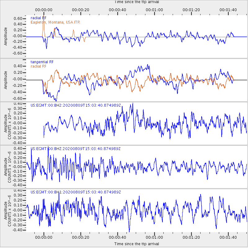
EGMT Eagleton, Montana, USA - Earthquake Result Viewer
*The percent match for this event was below the threshold and hence no stack was calculated.
| Earthquake location: |
Alaska Peninsula |
| Earthquake latitude/longitude: |
56.0/-158.8 |
| Earthquake time(UTC): |
2020/08/09 (222) 14:58:00 GMT |
| Earthquake Depth: |
37 km |
| Earthquake Magnitude: |
5.7 ml |
| Earthquake Catalog/Contributor: |
NEIC PDE/ak |
|
| Network: |
US United States National Seismic Network |
| Station: |
EGMT Eagleton, Montana, USA |
| Lat/Lon: |
48.02 N/109.75 W |
| Elevation: |
1055 m |
|
| Distance: |
30.7 deg |
| Az: |
84.059 deg |
| Baz: |
303.626 deg |
| Ray Param: |
$rayparam |
*The percent match for this event was below the threshold and hence was not used in the summary stack. |
|
| Radial Match: |
43.605015 % |
| Radial Bump: |
400 |
| Transverse Match: |
41.926884 % |
| Transverse Bump: |
400 |
| SOD ConfigId: |
21709731 |
| Insert Time: |
2020-08-23 15:16:56.677 +0000 |
| GWidth: |
2.5 |
| Max Bumps: |
400 |
| Tol: |
0.001 |
|
Signal To Noise
| Channel | StoN | STA | LTA |
| US:EGMT:00:BHZ:20200809T15:03:40.874989Z | 2.0590641 | 1.8154914E-7 | 8.817071E-8 |
| US:EGMT:00:BH1:20200809T15:03:40.874989Z | 1.1004089 | 1.3825239E-7 | 1.256373E-7 |
| US:EGMT:00:BH2:20200809T15:03:40.874989Z | 1.3949845 | 1.2550727E-7 | 8.997037E-8 |
| Arrivals |
| Ps | |
| PpPs | |
| PsPs/PpSs | |


