You are here: Home > Network List > CI - Caltech Regional Seismic Network Stations List
> Station MPM Manuel Prospect Mine, California, USA > Earthquake Result Viewer
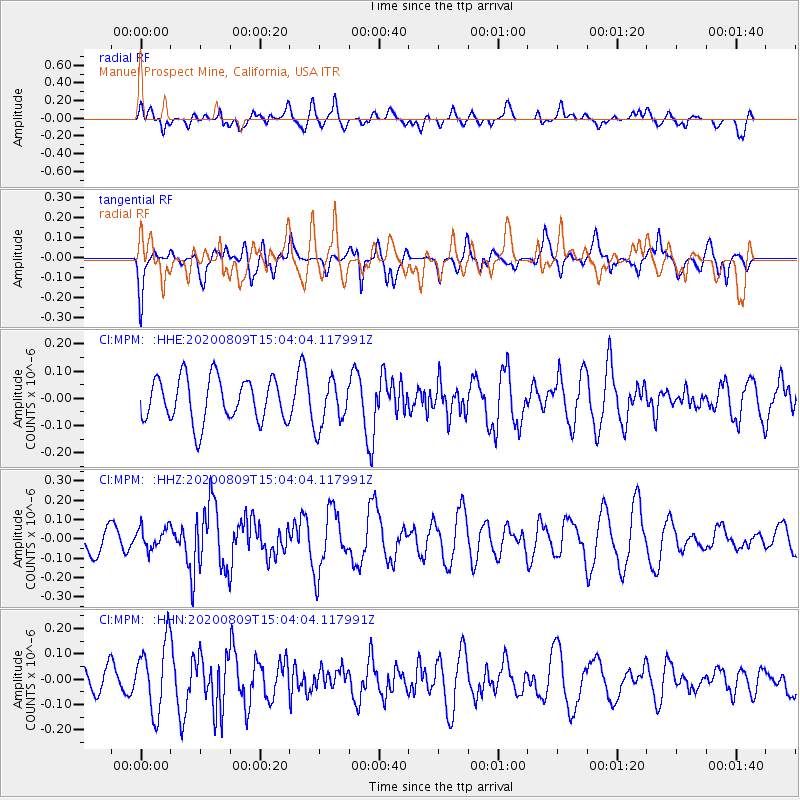
MPM Manuel Prospect Mine, California, USA - Earthquake Result Viewer
*The percent match for this event was below the threshold and hence no stack was calculated.
| Earthquake location: |
Alaska Peninsula |
| Earthquake latitude/longitude: |
55.5/-158.1 |
| Earthquake time(UTC): |
2020/08/09 (222) 14:57:52 GMT |
| Earthquake Depth: |
0.0 km |
| Earthquake Magnitude: |
5.6 ml |
| Earthquake Catalog/Contributor: |
NEIC PDE/ak |
|
| Network: |
CI Caltech Regional Seismic Network |
| Station: |
MPM Manuel Prospect Mine, California, USA |
| Lat/Lon: |
36.06 N/117.49 W |
| Elevation: |
185 m |
|
| Distance: |
33.7 deg |
| Az: |
108.119 deg |
| Baz: |
318.107 deg |
| Ray Param: |
$rayparam |
*The percent match for this event was below the threshold and hence was not used in the summary stack. |
|
| Radial Match: |
53.69664 % |
| Radial Bump: |
400 |
| Transverse Match: |
60.79593 % |
| Transverse Bump: |
400 |
| SOD ConfigId: |
21709731 |
| Insert Time: |
2020-08-23 15:21:48.881 +0000 |
| GWidth: |
2.5 |
| Max Bumps: |
400 |
| Tol: |
0.001 |
|
Signal To Noise
| Channel | StoN | STA | LTA |
| CI:MPM: :HHZ:20200809T15:04:04.117991Z | 0.642423 | 5.521477E-8 | 8.594769E-8 |
| CI:MPM: :HHN:20200809T15:04:04.117991Z | 3.0248268 | 1.385818E-7 | 4.5814787E-8 |
| CI:MPM: :HHE:20200809T15:04:04.117991Z | 1.0737994 | 8.581871E-8 | 7.9920625E-8 |
| Arrivals |
| Ps | |
| PpPs | |
| PsPs/PpSs | |


