You are here: Home > Network List > CI - Caltech Regional Seismic Network Stations List
> Station BFS Mt Baldy Forest Station > Earthquake Result Viewer
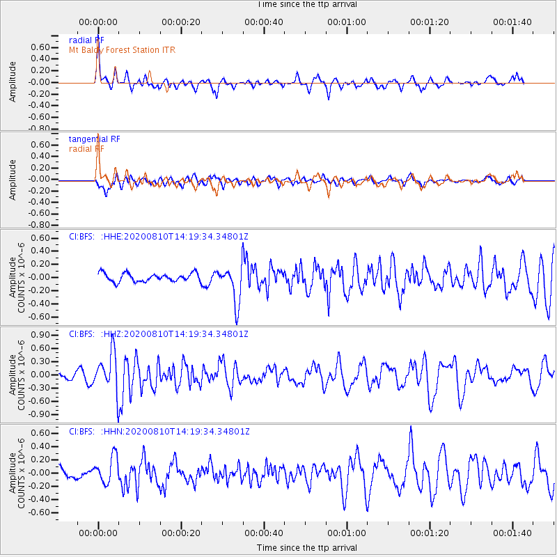
BFS Mt Baldy Forest Station - Earthquake Result Viewer
*The percent match for this event was below the threshold and hence no stack was calculated.
| Earthquake location: |
North Of Honduras |
| Earthquake latitude/longitude: |
16.9/-85.9 |
| Earthquake time(UTC): |
2020/08/10 (223) 14:13:27 GMT |
| Earthquake Depth: |
10 km |
| Earthquake Magnitude: |
5.7 Mww |
| Earthquake Catalog/Contributor: |
NEIC PDE/us |
|
| Network: |
CI Caltech Regional Seismic Network |
| Station: |
BFS Mt Baldy Forest Station |
| Lat/Lon: |
34.24 N/117.66 W |
| Elevation: |
1312 m |
|
| Distance: |
33.3 deg |
| Az: |
307.355 deg |
| Baz: |
113.26 deg |
| Ray Param: |
$rayparam |
*The percent match for this event was below the threshold and hence was not used in the summary stack. |
|
| Radial Match: |
73.33183 % |
| Radial Bump: |
400 |
| Transverse Match: |
51.76513 % |
| Transverse Bump: |
400 |
| SOD ConfigId: |
21709731 |
| Insert Time: |
2020-08-24 14:19:58.380 +0000 |
| GWidth: |
2.5 |
| Max Bumps: |
400 |
| Tol: |
0.001 |
|
Signal To Noise
| Channel | StoN | STA | LTA |
| CI:BFS: :HHZ:20200810T14:19:34.34801Z | 4.0352817 | 4.4963747E-7 | 1.1142653E-7 |
| CI:BFS: :HHN:20200810T14:19:34.34801Z | 1.8499109 | 2.1202354E-7 | 1.14612845E-7 |
| CI:BFS: :HHE:20200810T14:19:34.34801Z | 4.7083755 | 2.9628913E-7 | 6.29281E-8 |
| Arrivals |
| Ps | |
| PpPs | |
| PsPs/PpSs | |


