You are here: Home > Network List > CI - Caltech Regional Seismic Network Stations List
> Station SMM Simmler, CA, USA > Earthquake Result Viewer
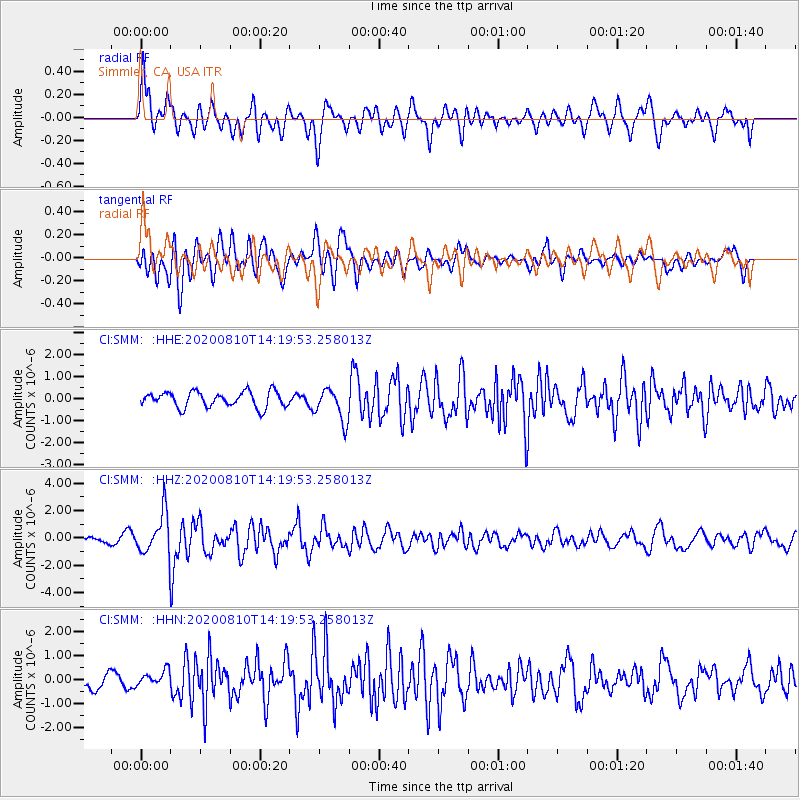
SMM Simmler, CA, USA - Earthquake Result Viewer
*The percent match for this event was below the threshold and hence no stack was calculated.
| Earthquake location: |
North Of Honduras |
| Earthquake latitude/longitude: |
16.9/-85.9 |
| Earthquake time(UTC): |
2020/08/10 (223) 14:13:27 GMT |
| Earthquake Depth: |
10 km |
| Earthquake Magnitude: |
5.7 Mww |
| Earthquake Catalog/Contributor: |
NEIC PDE/us |
|
| Network: |
CI Caltech Regional Seismic Network |
| Station: |
SMM Simmler, CA, USA |
| Lat/Lon: |
35.31 N/120.00 W |
| Elevation: |
599 m |
|
| Distance: |
35.5 deg |
| Az: |
307.787 deg |
| Baz: |
112.289 deg |
| Ray Param: |
$rayparam |
*The percent match for this event was below the threshold and hence was not used in the summary stack. |
|
| Radial Match: |
76.31696 % |
| Radial Bump: |
400 |
| Transverse Match: |
66.49317 % |
| Transverse Bump: |
400 |
| SOD ConfigId: |
21709731 |
| Insert Time: |
2020-08-24 14:21:12.179 +0000 |
| GWidth: |
2.5 |
| Max Bumps: |
400 |
| Tol: |
0.001 |
|
Signal To Noise
| Channel | StoN | STA | LTA |
| CI:SMM: :HHZ:20200810T14:19:53.258013Z | 10.4986 | 1.5008713E-6 | 1.4295918E-7 |
| CI:SMM: :HHN:20200810T14:19:53.258013Z | 0.8019177 | 3.1359204E-7 | 3.9105265E-7 |
| CI:SMM: :HHE:20200810T14:19:53.258013Z | 2.119202 | 7.5178394E-7 | 3.547486E-7 |
| Arrivals |
| Ps | |
| PpPs | |
| PsPs/PpSs | |


