You are here: Home > Network List > TA - USArray Transportable Network (new EarthScope stations) Stations List
> Station D25K Kavik River, AK, USA > Earthquake Result Viewer
D25K Kavik River, AK, USA - Earthquake Result Viewer
*The percent match for this event was below the threshold and hence no stack was calculated.
| Earthquake location: |
North Of Honduras |
| Earthquake latitude/longitude: |
16.9/-85.9 |
| Earthquake time(UTC): |
2020/08/10 (223) 14:13:27 GMT |
| Earthquake Depth: |
10 km |
| Earthquake Magnitude: |
5.7 Mww |
| Earthquake Catalog/Contributor: |
NEIC PDE/us |
|
| Network: |
TA USArray Transportable Network (new EarthScope stations) |
| Station: |
D25K Kavik River, AK, USA |
| Lat/Lon: |
69.32 N/146.38 W |
| Elevation: |
770 m |
|
| Distance: |
64.1 deg |
| Az: |
339.895 deg |
| Baz: |
112.082 deg |
| Ray Param: |
$rayparam |
*The percent match for this event was below the threshold and hence was not used in the summary stack. |
|
| Radial Match: |
79.84304 % |
| Radial Bump: |
400 |
| Transverse Match: |
65.20482 % |
| Transverse Bump: |
400 |
| SOD ConfigId: |
21709731 |
| Insert Time: |
2020-08-24 14:29:01.376 +0000 |
| GWidth: |
2.5 |
| Max Bumps: |
400 |
| Tol: |
0.001 |
|
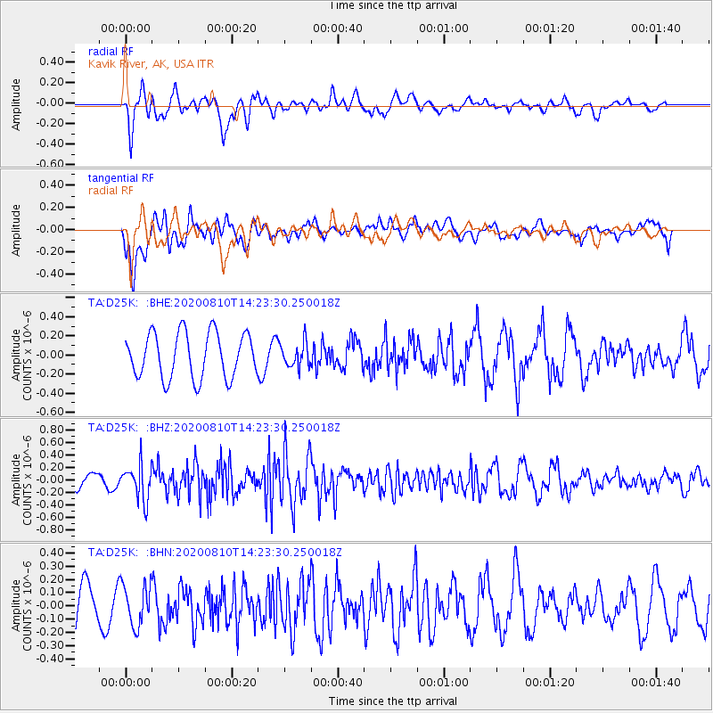
Signal To Noise
| Channel | StoN | STA | LTA |
| TA:D25K: :BHZ:20200810T14:23:30.250018Z | 1.8792791 | 2.8899024E-7 | 1.5377718E-7 |
| TA:D25K: :BHN:20200810T14:23:30.250018Z | 1.139941 | 1.5554161E-7 | 1.3644707E-7 |
| TA:D25K: :BHE:20200810T14:23:30.250018Z | 0.53640026 | 1.2611255E-7 | 2.3510904E-7 |
| Arrivals |
| Ps | |
| PpPs | |
| PsPs/PpSs | |


