You are here: Home > Network List > TA - USArray Transportable Network (new EarthScope stations) Stations List
> Station F21K Alatna River, AK, USA > Earthquake Result Viewer
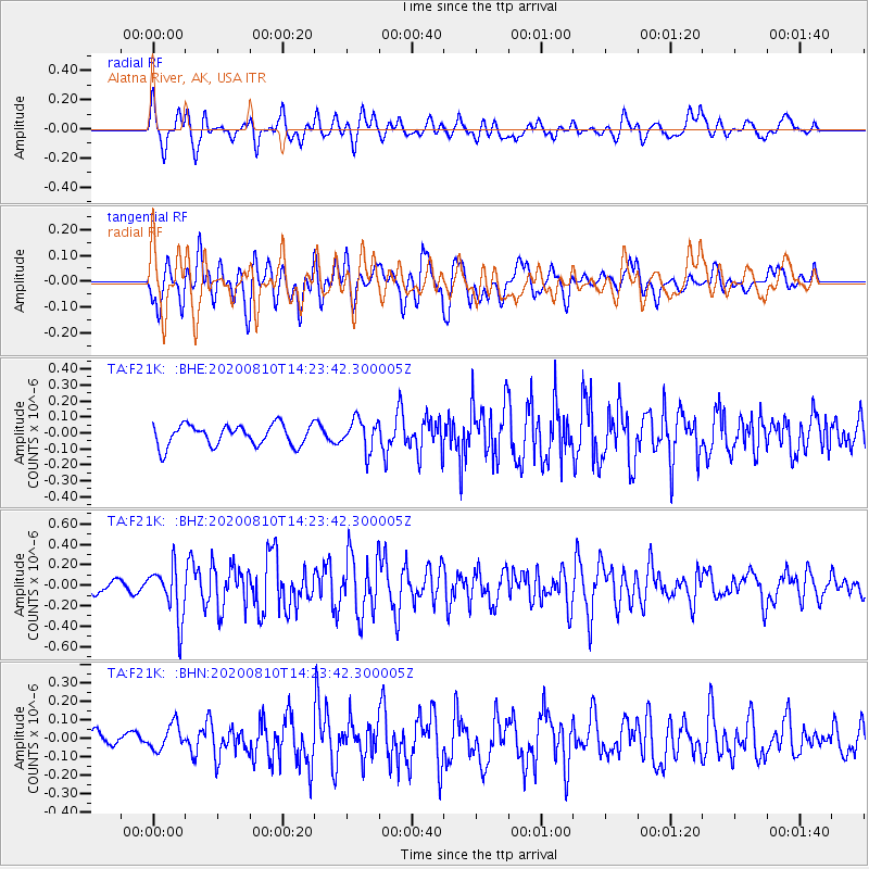
F21K Alatna River, AK, USA - Earthquake Result Viewer
*The percent match for this event was below the threshold and hence no stack was calculated.
| Earthquake location: |
North Of Honduras |
| Earthquake latitude/longitude: |
16.9/-85.9 |
| Earthquake time(UTC): |
2020/08/10 (223) 14:13:27 GMT |
| Earthquake Depth: |
10 km |
| Earthquake Magnitude: |
5.7 Mww |
| Earthquake Catalog/Contributor: |
NEIC PDE/us |
|
| Network: |
TA USArray Transportable Network (new EarthScope stations) |
| Station: |
F21K Alatna River, AK, USA |
| Lat/Lon: |
67.22 N/153.48 W |
| Elevation: |
597 m |
|
| Distance: |
65.9 deg |
| Az: |
336.779 deg |
| Baz: |
104.166 deg |
| Ray Param: |
$rayparam |
*The percent match for this event was below the threshold and hence was not used in the summary stack. |
|
| Radial Match: |
76.13634 % |
| Radial Bump: |
400 |
| Transverse Match: |
67.37009 % |
| Transverse Bump: |
400 |
| SOD ConfigId: |
21709731 |
| Insert Time: |
2020-08-24 14:29:19.909 +0000 |
| GWidth: |
2.5 |
| Max Bumps: |
400 |
| Tol: |
0.001 |
|
Signal To Noise
| Channel | StoN | STA | LTA |
| TA:F21K: :BHZ:20200810T14:23:42.300005Z | 2.6292107 | 2.5578888E-7 | 9.728732E-8 |
| TA:F21K: :BHN:20200810T14:23:42.300005Z | 1.2771685 | 6.821883E-8 | 5.341412E-8 |
| TA:F21K: :BHE:20200810T14:23:42.300005Z | 1.4535362 | 9.578883E-8 | 6.590055E-8 |
| Arrivals |
| Ps | |
| PpPs | |
| PsPs/PpSs | |


