You are here: Home > Network List > US - United States National Seismic Network Stations List
> Station EGMT Eagleton, Montana, USA > Earthquake Result Viewer
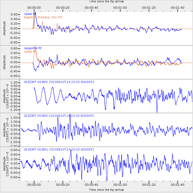
EGMT Eagleton, Montana, USA - Earthquake Result Viewer
*The percent match for this event was below the threshold and hence no stack was calculated.
| Earthquake location: |
North Of Honduras |
| Earthquake latitude/longitude: |
16.9/-85.9 |
| Earthquake time(UTC): |
2020/08/10 (223) 14:13:27 GMT |
| Earthquake Depth: |
10 km |
| Earthquake Magnitude: |
5.7 Mww |
| Earthquake Catalog/Contributor: |
NEIC PDE/us |
|
| Network: |
US United States National Seismic Network |
| Station: |
EGMT Eagleton, Montana, USA |
| Lat/Lon: |
48.02 N/109.75 W |
| Elevation: |
1055 m |
|
| Distance: |
36.7 deg |
| Az: |
332.959 deg |
| Baz: |
139.574 deg |
| Ray Param: |
$rayparam |
*The percent match for this event was below the threshold and hence was not used in the summary stack. |
|
| Radial Match: |
78.308174 % |
| Radial Bump: |
400 |
| Transverse Match: |
66.04957 % |
| Transverse Bump: |
400 |
| SOD ConfigId: |
21709731 |
| Insert Time: |
2020-08-24 14:31:10.067 +0000 |
| GWidth: |
2.5 |
| Max Bumps: |
400 |
| Tol: |
0.001 |
|
Signal To Noise
| Channel | StoN | STA | LTA |
| US:EGMT:00:BHZ:20200810T14:20:03.800005Z | 3.308661 | 4.7516428E-7 | 1.4361227E-7 |
| US:EGMT:00:BH1:20200810T14:20:03.800005Z | 0.8304692 | 1.7371738E-7 | 2.0917982E-7 |
| US:EGMT:00:BH2:20200810T14:20:03.800005Z | 0.52207345 | 2.2563094E-7 | 4.3218236E-7 |
| Arrivals |
| Ps | |
| PpPs | |
| PsPs/PpSs | |


