You are here: Home > Network List > TA - USArray Transportable Network (new EarthScope stations) Stations List
> Station E20K Nigu River, AK, USA > Earthquake Result Viewer
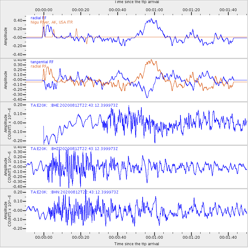
E20K Nigu River, AK, USA - Earthquake Result Viewer
*The percent match for this event was below the threshold and hence no stack was calculated.
| Earthquake location: |
Philippine Islands Region |
| Earthquake latitude/longitude: |
19.9/121.3 |
| Earthquake time(UTC): |
2020/08/12 (225) 22:32:38 GMT |
| Earthquake Depth: |
10 km |
| Earthquake Magnitude: |
5.5 Mww |
| Earthquake Catalog/Contributor: |
NEIC PDE/us |
|
| Network: |
TA USArray Transportable Network (new EarthScope stations) |
| Station: |
E20K Nigu River, AK, USA |
| Lat/Lon: |
68.26 N/156.19 W |
| Elevation: |
866 m |
|
| Distance: |
68.9 deg |
| Az: |
23.327 deg |
| Baz: |
270.795 deg |
| Ray Param: |
$rayparam |
*The percent match for this event was below the threshold and hence was not used in the summary stack. |
|
| Radial Match: |
34.353737 % |
| Radial Bump: |
400 |
| Transverse Match: |
47.77294 % |
| Transverse Bump: |
400 |
| SOD ConfigId: |
21709731 |
| Insert Time: |
2020-08-26 22:42:59.818 +0000 |
| GWidth: |
2.5 |
| Max Bumps: |
400 |
| Tol: |
0.001 |
|
Signal To Noise
| Channel | StoN | STA | LTA |
| TA:E20K: :BHZ:20200812T22:43:12.399973Z | 1.694001 | 1.0984993E-7 | 6.484644E-8 |
| TA:E20K: :BHN:20200812T22:43:12.399973Z | 0.44122273 | 3.940121E-8 | 8.930005E-8 |
| TA:E20K: :BHE:20200812T22:43:12.399973Z | 0.90323305 | 8.349514E-8 | 9.24403E-8 |
| Arrivals |
| Ps | |
| PpPs | |
| PsPs/PpSs | |


