You are here: Home > Network List > TA - USArray Transportable Network (new EarthScope stations) Stations List
> Station L15K Ungalak Mountain, AK, USA > Earthquake Result Viewer
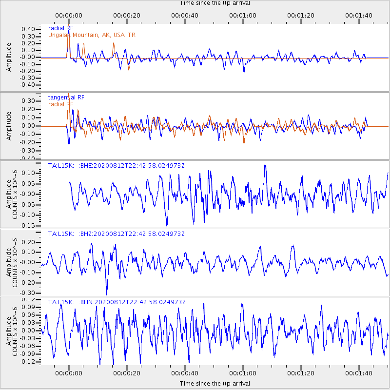
L15K Ungalak Mountain, AK, USA - Earthquake Result Viewer
*The percent match for this event was below the threshold and hence no stack was calculated.
| Earthquake location: |
Philippine Islands Region |
| Earthquake latitude/longitude: |
19.9/121.3 |
| Earthquake time(UTC): |
2020/08/12 (225) 22:32:38 GMT |
| Earthquake Depth: |
10 km |
| Earthquake Magnitude: |
5.5 Mww |
| Earthquake Catalog/Contributor: |
NEIC PDE/us |
|
| Network: |
TA USArray Transportable Network (new EarthScope stations) |
| Station: |
L15K Ungalak Mountain, AK, USA |
| Lat/Lon: |
61.68 N/161.49 W |
| Elevation: |
219 m |
|
| Distance: |
66.6 deg |
| Az: |
30.448 deg |
| Baz: |
268.69 deg |
| Ray Param: |
$rayparam |
*The percent match for this event was below the threshold and hence was not used in the summary stack. |
|
| Radial Match: |
60.211643 % |
| Radial Bump: |
400 |
| Transverse Match: |
49.165367 % |
| Transverse Bump: |
400 |
| SOD ConfigId: |
21709731 |
| Insert Time: |
2020-08-26 22:43:37.460 +0000 |
| GWidth: |
2.5 |
| Max Bumps: |
400 |
| Tol: |
0.001 |
|
Signal To Noise
| Channel | StoN | STA | LTA |
| TA:L15K: :BHZ:20200812T22:42:58.024973Z | 1.0229052 | 8.0739085E-8 | 7.893115E-8 |
| TA:L15K: :BHN:20200812T22:42:58.024973Z | 1.3774445 | 5.0375338E-8 | 3.6571592E-8 |
| TA:L15K: :BHE:20200812T22:42:58.024973Z | 2.150303 | 6.8310094E-8 | 3.1767662E-8 |
| Arrivals |
| Ps | |
| PpPs | |
| PsPs/PpSs | |


