You are here: Home > Network List > IU - Global Seismograph Network (GSN - IRIS/USGS) Stations List
> Station CTAO Charters Towers, Australia > Earthquake Result Viewer
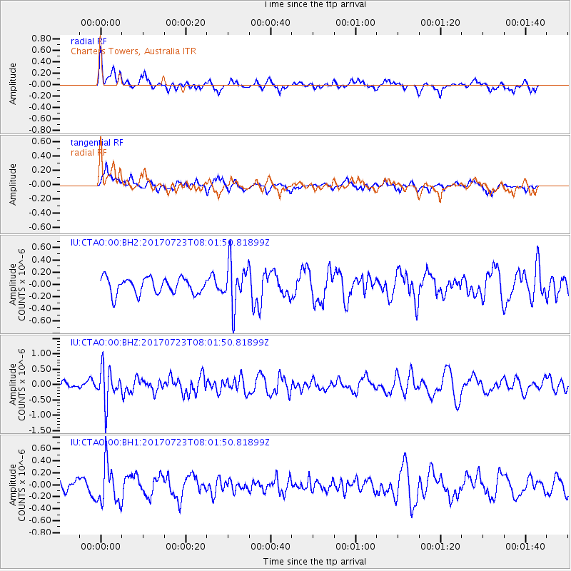
CTAO Charters Towers, Australia - Earthquake Result Viewer
*The percent match for this event was below the threshold and hence no stack was calculated.
| Earthquake location: |
Minahassa Peninsula, Sulawesi |
| Earthquake latitude/longitude: |
0.3/120.2 |
| Earthquake time(UTC): |
2017/07/23 (204) 07:55:55 GMT |
| Earthquake Depth: |
56 km |
| Earthquake Magnitude: |
5.5 Mww |
| Earthquake Catalog/Contributor: |
NEIC PDE/us |
|
| Network: |
IU Global Seismograph Network (GSN - IRIS/USGS) |
| Station: |
CTAO Charters Towers, Australia |
| Lat/Lon: |
20.09 S/146.25 E |
| Elevation: |
357 m |
|
| Distance: |
32.6 deg |
| Az: |
129.945 deg |
| Baz: |
305.346 deg |
| Ray Param: |
$rayparam |
*The percent match for this event was below the threshold and hence was not used in the summary stack. |
|
| Radial Match: |
54.156246 % |
| Radial Bump: |
366 |
| Transverse Match: |
61.608868 % |
| Transverse Bump: |
400 |
| SOD ConfigId: |
2140511 |
| Insert Time: |
2017-08-05 23:49:55.517 +0000 |
| GWidth: |
2.5 |
| Max Bumps: |
400 |
| Tol: |
0.001 |
|
Signal To Noise
| Channel | StoN | STA | LTA |
| IU:CTAO:00:BHZ:20170723T08:01:50.81899Z | 3.6611123 | 5.681477E-7 | 1.5518444E-7 |
| IU:CTAO:00:BH1:20170723T08:01:50.81899Z | 2.3268387 | 3.3668124E-7 | 1.446947E-7 |
| IU:CTAO:00:BH2:20170723T08:01:50.81899Z | 2.793639 | 3.6245808E-7 | 1.2974407E-7 |
| Arrivals |
| Ps | |
| PpPs | |
| PsPs/PpSs | |


