You are here: Home > Network List > US - United States National Seismic Network Stations List
> Station MNTX Cornudas Mountains, Texas, USA > Earthquake Result Viewer
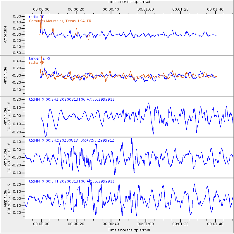
MNTX Cornudas Mountains, Texas, USA - Earthquake Result Viewer
*The percent match for this event was below the threshold and hence no stack was calculated.
| Earthquake location: |
Unimak Island Region, Alaska |
| Earthquake latitude/longitude: |
53.4/-163.7 |
| Earthquake time(UTC): |
2020/08/13 (226) 06:39:58 GMT |
| Earthquake Depth: |
10 km |
| Earthquake Magnitude: |
5.7 mww |
| Earthquake Catalog/Contributor: |
NEIC PDE/us |
|
| Network: |
US United States National Seismic Network |
| Station: |
MNTX Cornudas Mountains, Texas, USA |
| Lat/Lon: |
31.70 N/105.38 W |
| Elevation: |
404 m |
|
| Distance: |
46.6 deg |
| Az: |
93.605 deg |
| Baz: |
315.511 deg |
| Ray Param: |
$rayparam |
*The percent match for this event was below the threshold and hence was not used in the summary stack. |
|
| Radial Match: |
64.42051 % |
| Radial Bump: |
400 |
| Transverse Match: |
68.11619 % |
| Transverse Bump: |
400 |
| SOD ConfigId: |
21709731 |
| Insert Time: |
2020-08-27 07:00:10.278 +0000 |
| GWidth: |
2.5 |
| Max Bumps: |
400 |
| Tol: |
0.001 |
|
Signal To Noise
| Channel | StoN | STA | LTA |
| US:MNTX:00:BHZ:20200813T06:47:55.299991Z | 1.0311193 | 7.839828E-8 | 7.603221E-8 |
| US:MNTX:00:BH1:20200813T06:47:55.299991Z | 0.8801811 | 4.5034678E-8 | 5.1165244E-8 |
| US:MNTX:00:BH2:20200813T06:47:55.299991Z | 0.76806647 | 5.8239362E-8 | 7.582594E-8 |
| Arrivals |
| Ps | |
| PpPs | |
| PsPs/PpSs | |


