You are here: Home > Network List > US - United States National Seismic Network Stations List
> Station MSO Missoula, Montana, USA > Earthquake Result Viewer
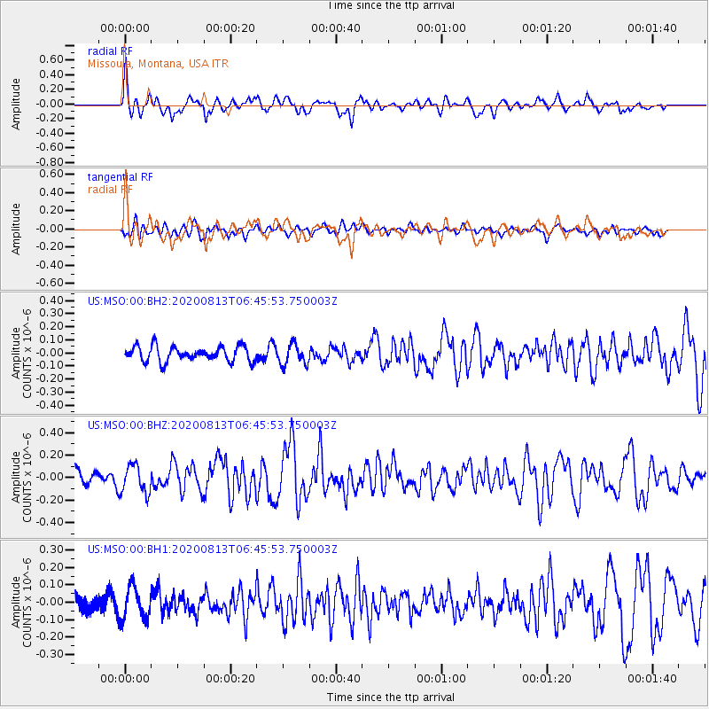
MSO Missoula, Montana, USA - Earthquake Result Viewer
*The percent match for this event was below the threshold and hence no stack was calculated.
| Earthquake location: |
Unimak Island Region, Alaska |
| Earthquake latitude/longitude: |
53.4/-163.7 |
| Earthquake time(UTC): |
2020/08/13 (226) 06:39:58 GMT |
| Earthquake Depth: |
10 km |
| Earthquake Magnitude: |
5.7 mww |
| Earthquake Catalog/Contributor: |
NEIC PDE/us |
|
| Network: |
US United States National Seismic Network |
| Station: |
MSO Missoula, Montana, USA |
| Lat/Lon: |
46.83 N/113.94 W |
| Elevation: |
1264 m |
|
| Distance: |
32.0 deg |
| Az: |
81.344 deg |
| Baz: |
300.484 deg |
| Ray Param: |
$rayparam |
*The percent match for this event was below the threshold and hence was not used in the summary stack. |
|
| Radial Match: |
72.77949 % |
| Radial Bump: |
393 |
| Transverse Match: |
56.977238 % |
| Transverse Bump: |
400 |
| SOD ConfigId: |
21709731 |
| Insert Time: |
2020-08-27 07:00:11.457 +0000 |
| GWidth: |
2.5 |
| Max Bumps: |
400 |
| Tol: |
0.001 |
|
Signal To Noise
| Channel | StoN | STA | LTA |
| US:MSO:00:BHZ:20200813T06:45:53.750003Z | 2.5760605 | 1.2343381E-7 | 4.7915723E-8 |
| US:MSO:00:BH1:20200813T06:45:53.750003Z | 2.502576 | 9.2901445E-8 | 3.7122327E-8 |
| US:MSO:00:BH2:20200813T06:45:53.750003Z | 1.4020159 | 8.063202E-8 | 5.7511485E-8 |
| Arrivals |
| Ps | |
| PpPs | |
| PsPs/PpSs | |


