KMBL Kambalda, Western Australia - Earthquake Result Viewer
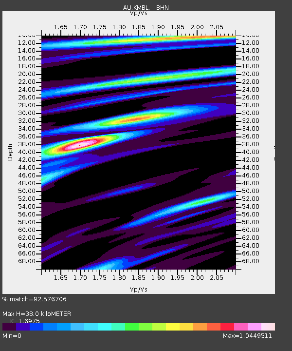
Earthquake location: Philippine Islands Region
Earthquake latitude/longitude: 5.1/127.2
Earthquake time(UTC): 2009/04/04 (094) 05:31:55 GMT
Earthquake Depth: 48 km
Earthquake Magnitude: 6.1 MB, 5.8 MS, 6.3 MW, 6.2 MW
Earthquake Catalog/Contributor: WHDF/NEIC
Network: AU Australian Seismological Centre
Station: KMBL Kambalda, Western Australia
Lat/Lon: 31.37 S/121.88 E
Elevation: 370 m
Distance: 36.7 deg
Az: 187.631 deg
Baz: 8.895 deg
Ray Param: 0.07644001
Estimated Moho Depth: 38.0 km
Estimated Crust Vp/Vs: 1.70
Assumed Crust Vp: 6.459 km/s
Estimated Crust Vs: 3.805 km/s
Estimated Crust Poisson's Ratio: 0.23
Radial Match: 92.576706 %
Radial Bump: 306
Transverse Match: 81.889175 %
Transverse Bump: 400
SOD ConfigId: 2658
Insert Time: 2010-03-09 00:01:22.098 +0000
GWidth: 2.5
Max Bumps: 400
Tol: 0.001

Signal To Noise

ChannelStoNSTALTA
AU:KMBL: :BHN:20090404T05:38:27.193989Z20.6017066.5218874E-63.1657027E-7
AU:KMBL: :BHE:20090404T05:38:27.193989Z12.9081014.0775894E-63.1589386E-7
AU:KMBL: :BHZ:20090404T05:38:27.193989Z2.7558955.766277E-72.0923429E-7
Arrivals
Ps4.4 SECOND
PpPs15 SECOND
PsPs/PpSs19 SECOND