You are here: Home > Network List > CN - Canadian National Seismograph Network Stations List
> Station INK INUVIK, NT > Earthquake Result Viewer
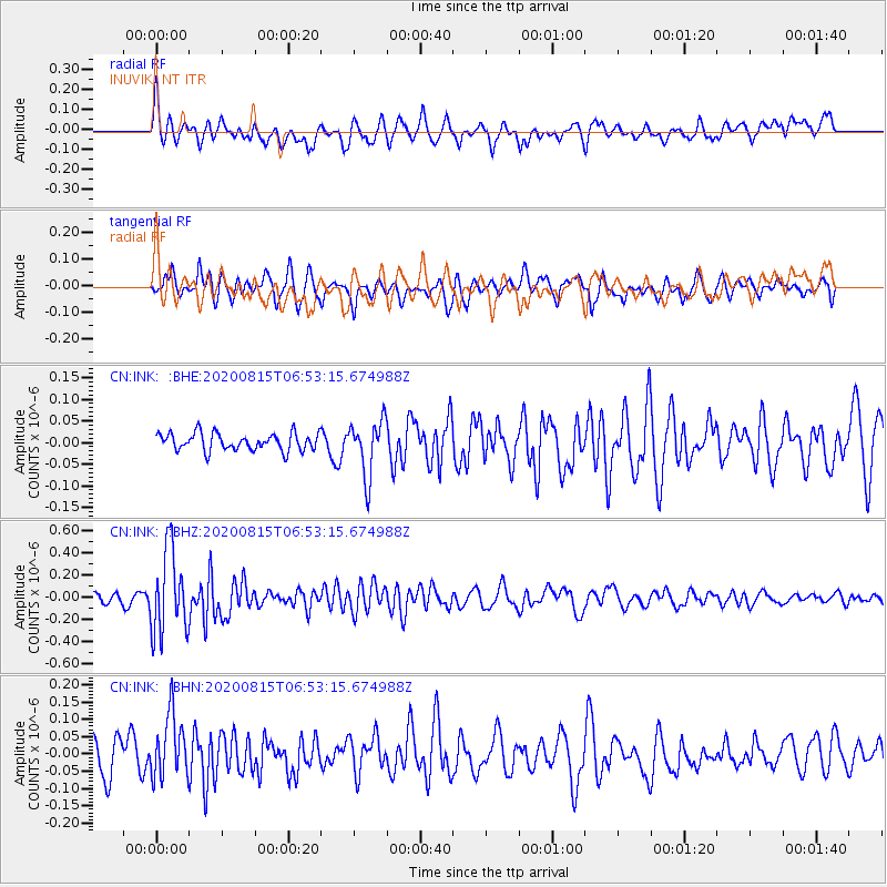
INK INUVIK, NT - Earthquake Result Viewer
*The percent match for this event was below the threshold and hence no stack was calculated.
| Earthquake location: |
Easter Island Region |
| Earthquake latitude/longitude: |
-22.7/-112.3 |
| Earthquake time(UTC): |
2020/08/15 (228) 06:40:38 GMT |
| Earthquake Depth: |
10 km |
| Earthquake Magnitude: |
5.7 mww |
| Earthquake Catalog/Contributor: |
NEIC PDE/us |
|
| Network: |
CN Canadian National Seismograph Network |
| Station: |
INK INUVIK, NT |
| Lat/Lon: |
68.31 N/133.53 W |
| Elevation: |
44 m |
|
| Distance: |
92.1 deg |
| Az: |
352.264 deg |
| Baz: |
160.466 deg |
| Ray Param: |
$rayparam |
*The percent match for this event was below the threshold and hence was not used in the summary stack. |
|
| Radial Match: |
68.07161 % |
| Radial Bump: |
400 |
| Transverse Match: |
65.51384 % |
| Transverse Bump: |
400 |
| SOD ConfigId: |
21709731 |
| Insert Time: |
2020-08-29 06:54:38.165 +0000 |
| GWidth: |
2.5 |
| Max Bumps: |
400 |
| Tol: |
0.001 |
|
Signal To Noise
| Channel | StoN | STA | LTA |
| CN:INK: :BHZ:20200815T06:53:15.674988Z | 8.147329 | 3.781336E-7 | 4.6411966E-8 |
| CN:INK: :BHN:20200815T06:53:15.674988Z | 1.8887553 | 9.4382415E-8 | 4.9970694E-8 |
| CN:INK: :BHE:20200815T06:53:15.674988Z | 3.2037504 | 6.3775836E-8 | 1.9906619E-8 |
| Arrivals |
| Ps | |
| PpPs | |
| PsPs/PpSs | |


