You are here: Home > Network List > G - GEOSCOPE Stations List
> Station MPG Montagne des Peres, French Guyana > Earthquake Result Viewer
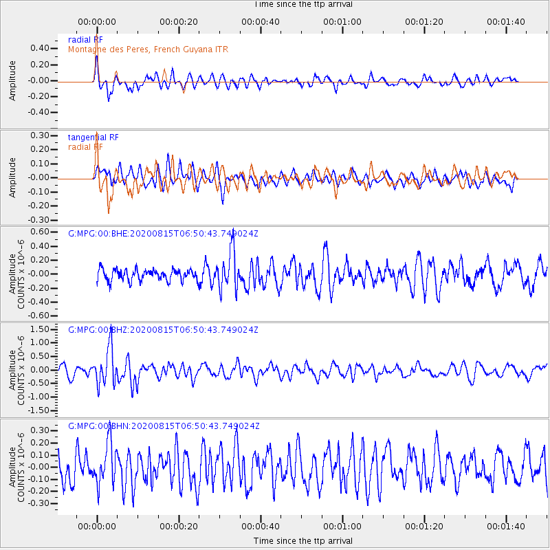
MPG Montagne des Peres, French Guyana - Earthquake Result Viewer
*The percent match for this event was below the threshold and hence no stack was calculated.
| Earthquake location: |
Easter Island Region |
| Earthquake latitude/longitude: |
-22.7/-112.3 |
| Earthquake time(UTC): |
2020/08/15 (228) 06:40:38 GMT |
| Earthquake Depth: |
10 km |
| Earthquake Magnitude: |
5.7 mww |
| Earthquake Catalog/Contributor: |
NEIC PDE/us |
|
| Network: |
G GEOSCOPE |
| Station: |
MPG Montagne des Peres, French Guyana |
| Lat/Lon: |
5.11 N/52.64 W |
| Elevation: |
147 m |
|
| Distance: |
64.5 deg |
| Az: |
72.284 deg |
| Baz: |
242.029 deg |
| Ray Param: |
$rayparam |
*The percent match for this event was below the threshold and hence was not used in the summary stack. |
|
| Radial Match: |
69.22521 % |
| Radial Bump: |
400 |
| Transverse Match: |
62.524483 % |
| Transverse Bump: |
400 |
| SOD ConfigId: |
21709731 |
| Insert Time: |
2020-08-29 06:57:28.655 +0000 |
| GWidth: |
2.5 |
| Max Bumps: |
400 |
| Tol: |
0.001 |
|
Signal To Noise
| Channel | StoN | STA | LTA |
| G:MPG:00:BHZ:20200815T06:50:43.749024Z | 3.8314714 | 6.896941E-7 | 1.8000765E-7 |
| G:MPG:00:BHN:20200815T06:50:43.749024Z | 1.786779 | 1.780874E-7 | 9.966951E-8 |
| G:MPG:00:BHE:20200815T06:50:43.749024Z | 3.476 | 2.7935775E-7 | 8.036759E-8 |
| Arrivals |
| Ps | |
| PpPs | |
| PsPs/PpSs | |


