You are here: Home > Network List > BK - Berkeley Digital Seismograph Network Stations List
> Station HUMO Hull Mountain, OR > Earthquake Result Viewer
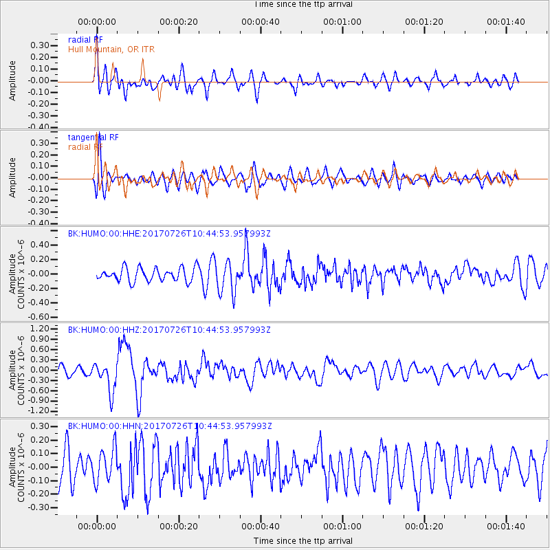
HUMO Hull Mountain, OR - Earthquake Result Viewer
*The percent match for this event was below the threshold and hence no stack was calculated.
| Earthquake location: |
Southeast Of Ryukyu Islands |
| Earthquake latitude/longitude: |
26.9/130.2 |
| Earthquake time(UTC): |
2017/07/26 (207) 10:32:57 GMT |
| Earthquake Depth: |
10 km |
| Earthquake Magnitude: |
5.9 Mww |
| Earthquake Catalog/Contributor: |
NEIC PDE/us |
|
| Network: |
BK Berkeley Digital Seismograph Network |
| Station: |
HUMO Hull Mountain, OR |
| Lat/Lon: |
42.61 N/122.96 W |
| Elevation: |
555 m |
|
| Distance: |
83.5 deg |
| Az: |
45.324 deg |
| Baz: |
300.685 deg |
| Ray Param: |
$rayparam |
*The percent match for this event was below the threshold and hence was not used in the summary stack. |
|
| Radial Match: |
57.244823 % |
| Radial Bump: |
400 |
| Transverse Match: |
65.92516 % |
| Transverse Bump: |
400 |
| SOD ConfigId: |
2140511 |
| Insert Time: |
2017-08-09 02:25:28.093 +0000 |
| GWidth: |
2.5 |
| Max Bumps: |
400 |
| Tol: |
0.001 |
|
Signal To Noise
| Channel | StoN | STA | LTA |
| BK:HUMO:00:HHZ:20170726T10:44:53.957993Z | 3.9570975 | 4.461419E-7 | 1.12744736E-7 |
| BK:HUMO:00:HHN:20170726T10:44:53.957993Z | 1.0926329 | 1.2821883E-7 | 1.173485E-7 |
| BK:HUMO:00:HHE:20170726T10:44:53.957993Z | 2.350869 | 2.1706065E-7 | 9.2332094E-8 |
| Arrivals |
| Ps | |
| PpPs | |
| PsPs/PpSs | |


