You are here: Home > Network List > G - GEOSCOPE Stations List
> Station CLF Chambon la Foret observatory, France > Earthquake Result Viewer
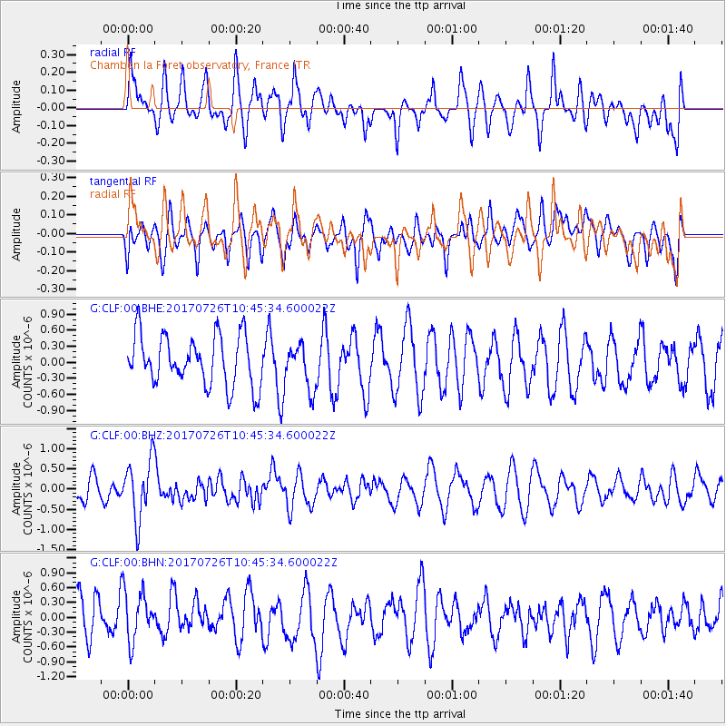
CLF Chambon la Foret observatory, France - Earthquake Result Viewer
*The percent match for this event was below the threshold and hence no stack was calculated.
| Earthquake location: |
Southeast Of Ryukyu Islands |
| Earthquake latitude/longitude: |
26.9/130.2 |
| Earthquake time(UTC): |
2017/07/26 (207) 10:32:57 GMT |
| Earthquake Depth: |
10 km |
| Earthquake Magnitude: |
5.9 Mww |
| Earthquake Catalog/Contributor: |
NEIC PDE/us |
|
| Network: |
G GEOSCOPE |
| Station: |
CLF Chambon la Foret observatory, France |
| Lat/Lon: |
48.03 N/2.26 E |
| Elevation: |
145 m |
|
| Distance: |
92.0 deg |
| Az: |
328.008 deg |
| Baz: |
44.804 deg |
| Ray Param: |
$rayparam |
*The percent match for this event was below the threshold and hence was not used in the summary stack. |
|
| Radial Match: |
53.034546 % |
| Radial Bump: |
400 |
| Transverse Match: |
39.19447 % |
| Transverse Bump: |
400 |
| SOD ConfigId: |
2140511 |
| Insert Time: |
2017-08-09 02:25:54.121 +0000 |
| GWidth: |
2.5 |
| Max Bumps: |
400 |
| Tol: |
0.001 |
|
Signal To Noise
| Channel | StoN | STA | LTA |
| G:CLF:00:BHZ:20170726T10:45:34.600022Z | 2.2922308 | 7.35313E-7 | 3.2078486E-7 |
| G:CLF:00:BHN:20170726T10:45:34.600022Z | 0.85074896 | 5.104513E-7 | 6.000023E-7 |
| G:CLF:00:BHE:20170726T10:45:34.600022Z | 0.88899595 | 4.1385587E-7 | 4.6553177E-7 |
| Arrivals |
| Ps | |
| PpPs | |
| PsPs/PpSs | |


