You are here: Home > Network List > TA - USArray Transportable Network (new EarthScope stations) Stations List
> Station H16K Elim, AK, USA > Earthquake Result Viewer
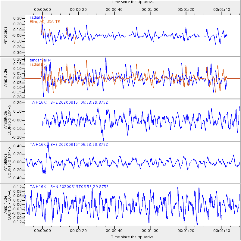
H16K Elim, AK, USA - Earthquake Result Viewer
*The percent match for this event was below the threshold and hence no stack was calculated.
| Earthquake location: |
Easter Island Region |
| Earthquake latitude/longitude: |
-22.7/-112.3 |
| Earthquake time(UTC): |
2020/08/15 (228) 06:40:38 GMT |
| Earthquake Depth: |
10 km |
| Earthquake Magnitude: |
5.7 mww |
| Earthquake Catalog/Contributor: |
NEIC PDE/us |
|
| Network: |
TA USArray Transportable Network (new EarthScope stations) |
| Station: |
H16K Elim, AK, USA |
| Lat/Lon: |
64.64 N/162.24 W |
| Elevation: |
216 m |
|
| Distance: |
95.2 deg |
| Az: |
340.676 deg |
| Baz: |
134.8 deg |
| Ray Param: |
$rayparam |
*The percent match for this event was below the threshold and hence was not used in the summary stack. |
|
| Radial Match: |
56.16505 % |
| Radial Bump: |
400 |
| Transverse Match: |
51.777004 % |
| Transverse Bump: |
400 |
| SOD ConfigId: |
21709731 |
| Insert Time: |
2020-08-29 07:13:11.443 +0000 |
| GWidth: |
2.5 |
| Max Bumps: |
400 |
| Tol: |
0.001 |
|
Signal To Noise
| Channel | StoN | STA | LTA |
| TA:H16K: :BHZ:20200815T06:53:29.875Z | 3.38913 | 2.3623954E-7 | 6.9705074E-8 |
| TA:H16K: :BHN:20200815T06:53:29.875Z | 1.3517799 | 6.40379E-8 | 4.7373018E-8 |
| TA:H16K: :BHE:20200815T06:53:29.875Z | 2.399547 | 1.03095914E-7 | 4.296474E-8 |
| Arrivals |
| Ps | |
| PpPs | |
| PsPs/PpSs | |


