You are here: Home > Network List > TA - USArray Transportable Network (new EarthScope stations) Stations List
> Station M11K Mekoryuk, AK, USA > Earthquake Result Viewer
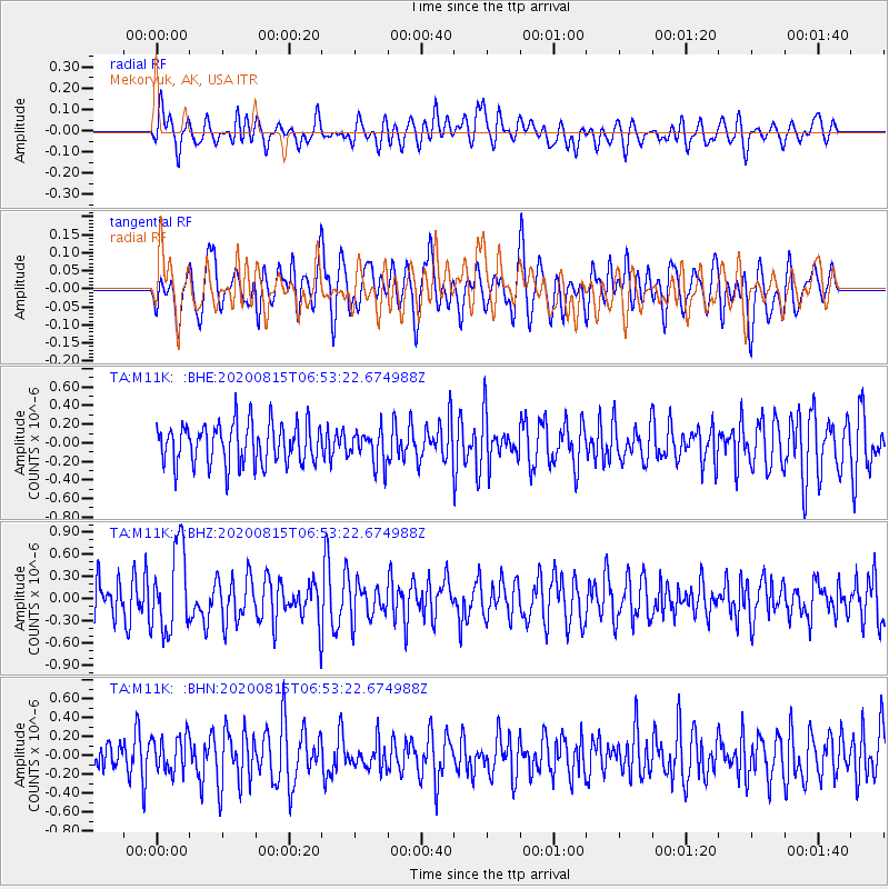
M11K Mekoryuk, AK, USA - Earthquake Result Viewer
*The percent match for this event was below the threshold and hence no stack was calculated.
| Earthquake location: |
Easter Island Region |
| Earthquake latitude/longitude: |
-22.7/-112.3 |
| Earthquake time(UTC): |
2020/08/15 (228) 06:40:38 GMT |
| Earthquake Depth: |
10 km |
| Earthquake Magnitude: |
5.7 mww |
| Earthquake Catalog/Contributor: |
NEIC PDE/us |
|
| Network: |
TA USArray Transportable Network (new EarthScope stations) |
| Station: |
M11K Mekoryuk, AK, USA |
| Lat/Lon: |
60.38 N/166.20 W |
| Elevation: |
3.0 m |
|
| Distance: |
93.6 deg |
| Az: |
336.294 deg |
| Baz: |
131.622 deg |
| Ray Param: |
$rayparam |
*The percent match for this event was below the threshold and hence was not used in the summary stack. |
|
| Radial Match: |
51.315094 % |
| Radial Bump: |
400 |
| Transverse Match: |
51.033306 % |
| Transverse Bump: |
400 |
| SOD ConfigId: |
21709731 |
| Insert Time: |
2020-08-29 07:13:51.545 +0000 |
| GWidth: |
2.5 |
| Max Bumps: |
400 |
| Tol: |
0.001 |
|
Signal To Noise
| Channel | StoN | STA | LTA |
| TA:M11K: :BHZ:20200815T06:53:22.674988Z | 2.4473684 | 5.5971094E-7 | 2.286991E-7 |
| TA:M11K: :BHN:20200815T06:53:22.674988Z | 1.0390106 | 1.9395388E-7 | 1.866717E-7 |
| TA:M11K: :BHE:20200815T06:53:22.674988Z | 0.8235535 | 1.7901333E-7 | 2.1736696E-7 |
| Arrivals |
| Ps | |
| PpPs | |
| PsPs/PpSs | |


