You are here: Home > Network List > US - United States National Seismic Network Stations List
> Station WMOK Wichita Mountains, Oklahoma, USA > Earthquake Result Viewer
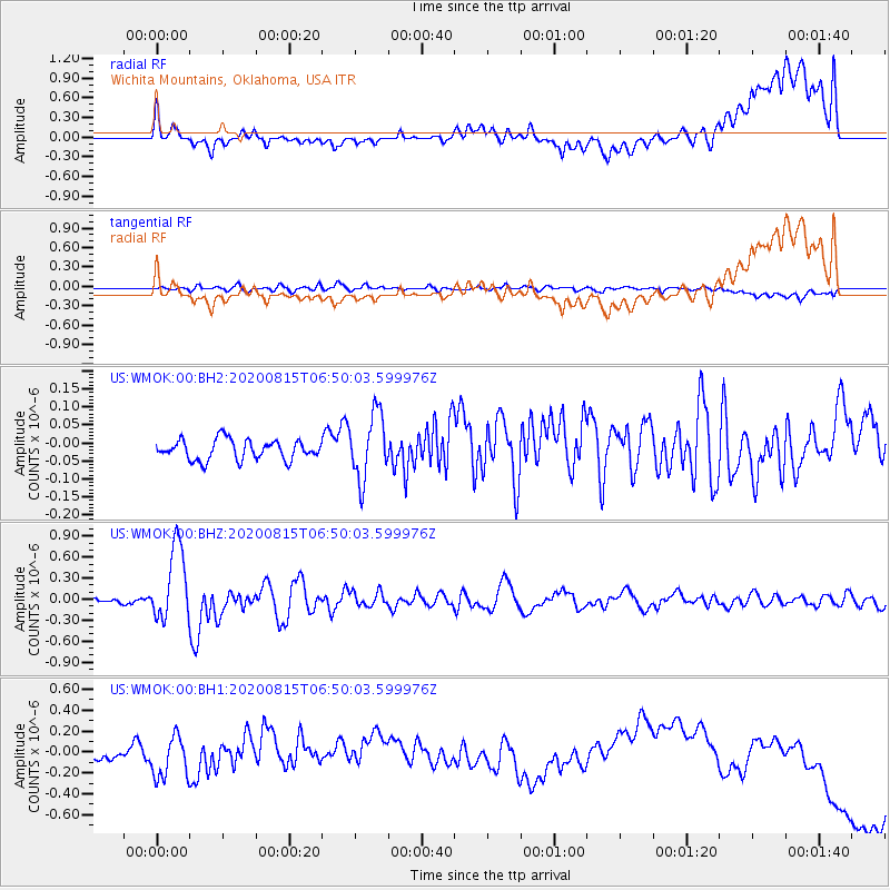
WMOK Wichita Mountains, Oklahoma, USA - Earthquake Result Viewer
*The percent match for this event was below the threshold and hence no stack was calculated.
| Earthquake location: |
Easter Island Region |
| Earthquake latitude/longitude: |
-22.7/-112.3 |
| Earthquake time(UTC): |
2020/08/15 (228) 06:40:38 GMT |
| Earthquake Depth: |
10 km |
| Earthquake Magnitude: |
5.7 mww |
| Earthquake Catalog/Contributor: |
NEIC PDE/us |
|
| Network: |
US United States National Seismic Network |
| Station: |
WMOK Wichita Mountains, Oklahoma, USA |
| Lat/Lon: |
34.74 N/98.78 W |
| Elevation: |
486 m |
|
| Distance: |
58.5 deg |
| Az: |
13.057 deg |
| Baz: |
194.675 deg |
| Ray Param: |
$rayparam |
*The percent match for this event was below the threshold and hence was not used in the summary stack. |
|
| Radial Match: |
39.411873 % |
| Radial Bump: |
400 |
| Transverse Match: |
49.594627 % |
| Transverse Bump: |
400 |
| SOD ConfigId: |
21709731 |
| Insert Time: |
2020-08-29 07:19:00.873 +0000 |
| GWidth: |
2.5 |
| Max Bumps: |
400 |
| Tol: |
0.001 |
|
Signal To Noise
| Channel | StoN | STA | LTA |
| US:WMOK:00:BHZ:20200815T06:50:03.599976Z | 10.296599 | 5.337973E-7 | 5.1842093E-8 |
| US:WMOK:00:BH1:20200815T06:50:03.599976Z | 3.7764008 | 1.9788453E-7 | 5.24003E-8 |
| US:WMOK:00:BH2:20200815T06:50:03.599976Z | 3.3194554 | 9.125519E-8 | 2.7491014E-8 |
| Arrivals |
| Ps | |
| PpPs | |
| PsPs/PpSs | |


