You are here: Home > Network List > IW - Intermountain West Stations List
> Station DLMT Dillon, Montana, USA > Earthquake Result Viewer
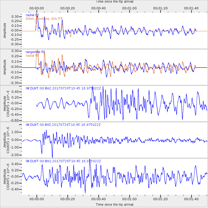
DLMT Dillon, Montana, USA - Earthquake Result Viewer
*The percent match for this event was below the threshold and hence no stack was calculated.
| Earthquake location: |
Southeast Of Ryukyu Islands |
| Earthquake latitude/longitude: |
26.9/130.2 |
| Earthquake time(UTC): |
2017/07/26 (207) 10:32:57 GMT |
| Earthquake Depth: |
10 km |
| Earthquake Magnitude: |
5.9 Mww |
| Earthquake Catalog/Contributor: |
NEIC PDE/us |
|
| Network: |
IW Intermountain West |
| Station: |
DLMT Dillon, Montana, USA |
| Lat/Lon: |
45.36 N/112.60 W |
| Elevation: |
1569 m |
|
| Distance: |
88.2 deg |
| Az: |
38.849 deg |
| Baz: |
307.4 deg |
| Ray Param: |
$rayparam |
*The percent match for this event was below the threshold and hence was not used in the summary stack. |
|
| Radial Match: |
75.53828 % |
| Radial Bump: |
400 |
| Transverse Match: |
72.03409 % |
| Transverse Bump: |
400 |
| SOD ConfigId: |
2140511 |
| Insert Time: |
2017-08-09 02:28:36.318 +0000 |
| GWidth: |
2.5 |
| Max Bumps: |
400 |
| Tol: |
0.001 |
|
Signal To Noise
| Channel | StoN | STA | LTA |
| IW:DLMT:00:BHZ:20170726T10:45:16.975022Z | 8.255059 | 5.723955E-7 | 6.9338746E-8 |
| IW:DLMT:00:BH1:20170726T10:45:16.975022Z | 1.8748425 | 1.4050102E-7 | 7.494017E-8 |
| IW:DLMT:00:BH2:20170726T10:45:16.975022Z | 2.0478923 | 1.9354057E-7 | 9.450719E-8 |
| Arrivals |
| Ps | |
| PpPs | |
| PsPs/PpSs | |


