You are here: Home > Network List > US - United States National Seismic Network Stations List
> Station AGMN Agassiz National Wildlife Refuge, Minnesota, USA > Earthquake Result Viewer
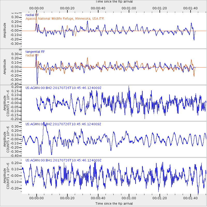
AGMN Agassiz National Wildlife Refuge, Minnesota, USA - Earthquake Result Viewer
*The percent match for this event was below the threshold and hence no stack was calculated.
| Earthquake location: |
Southeast Of Ryukyu Islands |
| Earthquake latitude/longitude: |
26.9/130.2 |
| Earthquake time(UTC): |
2017/07/26 (207) 10:32:57 GMT |
| Earthquake Depth: |
10 km |
| Earthquake Magnitude: |
5.9 Mww |
| Earthquake Catalog/Contributor: |
NEIC PDE/us |
|
| Network: |
US United States National Seismic Network |
| Station: |
AGMN Agassiz National Wildlife Refuge, Minnesota, USA |
| Lat/Lon: |
48.30 N/95.86 W |
| Elevation: |
351 m |
|
| Distance: |
94.5 deg |
| Az: |
28.832 deg |
| Baz: |
319.848 deg |
| Ray Param: |
$rayparam |
*The percent match for this event was below the threshold and hence was not used in the summary stack. |
|
| Radial Match: |
47.391747 % |
| Radial Bump: |
400 |
| Transverse Match: |
47.139027 % |
| Transverse Bump: |
400 |
| SOD ConfigId: |
2140511 |
| Insert Time: |
2017-08-09 02:30:07.855 +0000 |
| GWidth: |
2.5 |
| Max Bumps: |
400 |
| Tol: |
0.001 |
|
Signal To Noise
| Channel | StoN | STA | LTA |
| US:AGMN:00:BHZ:20170726T10:45:46.124009Z | 3.7817085 | 1.9439202E-7 | 5.1403227E-8 |
| US:AGMN:00:BH1:20170726T10:45:46.124009Z | 0.9697238 | 8.34605E-8 | 8.606626E-8 |
| US:AGMN:00:BH2:20170726T10:45:46.124009Z | 1.3959298 | 6.9177744E-8 | 4.955675E-8 |
| Arrivals |
| Ps | |
| PpPs | |
| PsPs/PpSs | |


