You are here: Home > Network List > US - United States National Seismic Network Stations List
> Station HAWA Hanford, Washington, USA > Earthquake Result Viewer
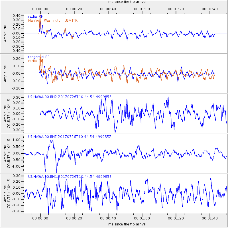
HAWA Hanford, Washington, USA - Earthquake Result Viewer
*The percent match for this event was below the threshold and hence no stack was calculated.
| Earthquake location: |
Southeast Of Ryukyu Islands |
| Earthquake latitude/longitude: |
26.9/130.2 |
| Earthquake time(UTC): |
2017/07/26 (207) 10:32:57 GMT |
| Earthquake Depth: |
10 km |
| Earthquake Magnitude: |
5.9 Mww |
| Earthquake Catalog/Contributor: |
NEIC PDE/us |
|
| Network: |
US United States National Seismic Network |
| Station: |
HAWA Hanford, Washington, USA |
| Lat/Lon: |
46.39 N/119.53 W |
| Elevation: |
364 m |
|
| Distance: |
83.6 deg |
| Az: |
40.789 deg |
| Baz: |
302.572 deg |
| Ray Param: |
$rayparam |
*The percent match for this event was below the threshold and hence was not used in the summary stack. |
|
| Radial Match: |
74.86836 % |
| Radial Bump: |
400 |
| Transverse Match: |
69.84494 % |
| Transverse Bump: |
400 |
| SOD ConfigId: |
2140511 |
| Insert Time: |
2017-08-09 02:30:33.245 +0000 |
| GWidth: |
2.5 |
| Max Bumps: |
400 |
| Tol: |
0.001 |
|
Signal To Noise
| Channel | StoN | STA | LTA |
| US:HAWA:00:BHZ:20170726T10:44:54.499985Z | 6.825375 | 4.4497114E-7 | 6.519365E-8 |
| US:HAWA:00:BH1:20170726T10:44:54.499985Z | 1.882853 | 1.343076E-7 | 7.133196E-8 |
| US:HAWA:00:BH2:20170726T10:44:54.499985Z | 2.049878 | 1.2252956E-7 | 5.977407E-8 |
| Arrivals |
| Ps | |
| PpPs | |
| PsPs/PpSs | |


