You are here: Home > Network List > US - United States National Seismic Network Stations List
> Station TPNV Topopah Spring, Nevada, USA > Earthquake Result Viewer
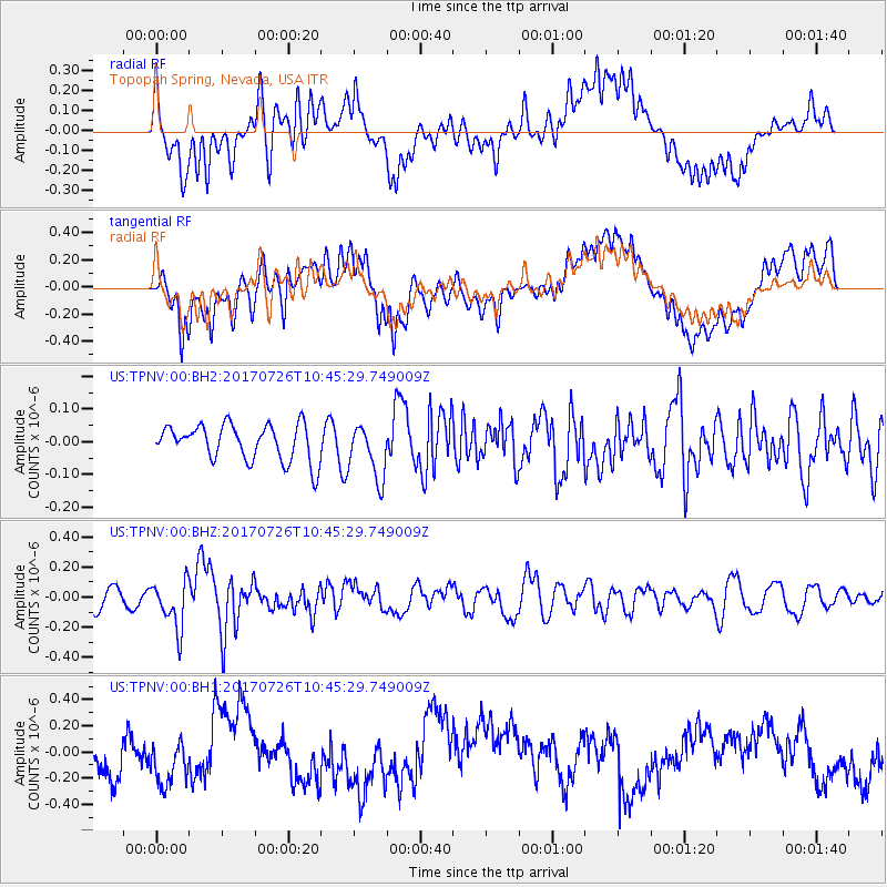
TPNV Topopah Spring, Nevada, USA - Earthquake Result Viewer
*The percent match for this event was below the threshold and hence no stack was calculated.
| Earthquake location: |
Southeast Of Ryukyu Islands |
| Earthquake latitude/longitude: |
26.9/130.2 |
| Earthquake time(UTC): |
2017/07/26 (207) 10:32:57 GMT |
| Earthquake Depth: |
10 km |
| Earthquake Magnitude: |
5.9 Mww |
| Earthquake Catalog/Contributor: |
NEIC PDE/us |
|
| Network: |
US United States National Seismic Network |
| Station: |
TPNV Topopah Spring, Nevada, USA |
| Lat/Lon: |
36.95 N/116.25 W |
| Elevation: |
1600 m |
|
| Distance: |
90.9 deg |
| Az: |
47.258 deg |
| Baz: |
305.061 deg |
| Ray Param: |
$rayparam |
*The percent match for this event was below the threshold and hence was not used in the summary stack. |
|
| Radial Match: |
38.96657 % |
| Radial Bump: |
400 |
| Transverse Match: |
47.071712 % |
| Transverse Bump: |
400 |
| SOD ConfigId: |
2140511 |
| Insert Time: |
2017-08-09 02:30:58.857 +0000 |
| GWidth: |
2.5 |
| Max Bumps: |
400 |
| Tol: |
0.001 |
|
Signal To Noise
| Channel | StoN | STA | LTA |
| US:TPNV:00:BHZ:20170726T10:45:29.749009Z | 1.7984518 | 1.5882749E-7 | 8.8313456E-8 |
| US:TPNV:00:BH1:20170726T10:45:29.749009Z | 0.67813325 | 1.6326513E-7 | 2.4075672E-7 |
| US:TPNV:00:BH2:20170726T10:45:29.749009Z | 1.5170428 | 8.327179E-8 | 5.4890865E-8 |
| Arrivals |
| Ps | |
| PpPs | |
| PsPs/PpSs | |


