You are here: Home > Network List > US - United States National Seismic Network Stations List
> Station CBKS Cedar Bluff, Kansas, USA > Earthquake Result Viewer
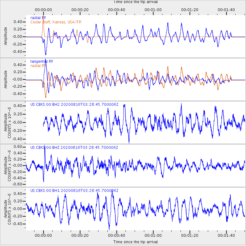
CBKS Cedar Bluff, Kansas, USA - Earthquake Result Viewer
*The percent match for this event was below the threshold and hence no stack was calculated.
| Earthquake location: |
Near Coast Of Northern Chile |
| Earthquake latitude/longitude: |
-19.3/-70.4 |
| Earthquake time(UTC): |
2020/08/16 (229) 03:18:49 GMT |
| Earthquake Depth: |
64 km |
| Earthquake Magnitude: |
5.1 Mww |
| Earthquake Catalog/Contributor: |
NEIC PDE/us |
|
| Network: |
US United States National Seismic Network |
| Station: |
CBKS Cedar Bluff, Kansas, USA |
| Lat/Lon: |
38.81 N/99.74 W |
| Elevation: |
677 m |
|
| Distance: |
64.0 deg |
| Az: |
334.754 deg |
| Baz: |
148.95 deg |
| Ray Param: |
$rayparam |
*The percent match for this event was below the threshold and hence was not used in the summary stack. |
|
| Radial Match: |
51.789898 % |
| Radial Bump: |
400 |
| Transverse Match: |
76.603226 % |
| Transverse Bump: |
400 |
| SOD ConfigId: |
21709731 |
| Insert Time: |
2020-08-30 03:36:14.491 +0000 |
| GWidth: |
2.5 |
| Max Bumps: |
400 |
| Tol: |
0.001 |
|
Signal To Noise
| Channel | StoN | STA | LTA |
| US:CBKS:00:BHZ:20200816T03:28:45.700006Z | 2.7433748 | 2.2854573E-7 | 8.3308244E-8 |
| US:CBKS:00:BH1:20200816T03:28:45.700006Z | 0.7916176 | 9.7021854E-8 | 1.2256153E-7 |
| US:CBKS:00:BH2:20200816T03:28:45.700006Z | 1.1010017 | 1.316512E-7 | 1.1957403E-7 |
| Arrivals |
| Ps | |
| PpPs | |
| PsPs/PpSs | |


