You are here: Home > Network List > WY - Yellowstone Wyoming Seismic Network Stations List
> Station YPP Pitchstone Plateau, YNP, WY, USA > Earthquake Result Viewer
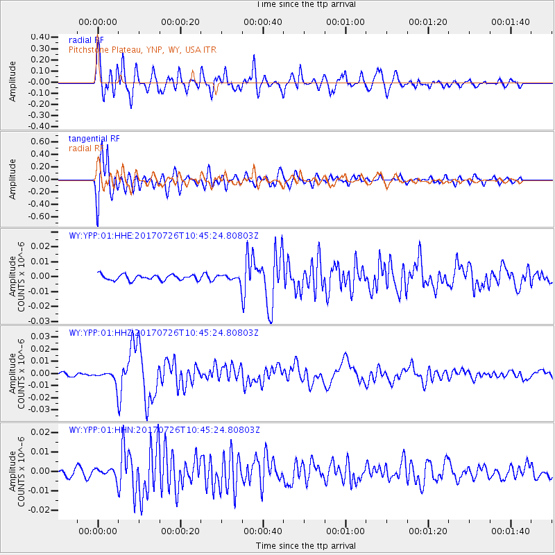
YPP Pitchstone Plateau, YNP, WY, USA - Earthquake Result Viewer
*The percent match for this event was below the threshold and hence no stack was calculated.
| Earthquake location: |
Southeast Of Ryukyu Islands |
| Earthquake latitude/longitude: |
26.9/130.2 |
| Earthquake time(UTC): |
2017/07/26 (207) 10:32:57 GMT |
| Earthquake Depth: |
10 km |
| Earthquake Magnitude: |
5.9 Mww |
| Earthquake Catalog/Contributor: |
NEIC PDE/us |
|
| Network: |
WY Yellowstone Wyoming Seismic Network |
| Station: |
YPP Pitchstone Plateau, YNP, WY, USA |
| Lat/Lon: |
44.27 N/110.80 W |
| Elevation: |
2707 m |
|
| Distance: |
89.9 deg |
| Az: |
38.923 deg |
| Baz: |
308.66 deg |
| Ray Param: |
$rayparam |
*The percent match for this event was below the threshold and hence was not used in the summary stack. |
|
| Radial Match: |
84.16709 % |
| Radial Bump: |
400 |
| Transverse Match: |
86.129974 % |
| Transverse Bump: |
400 |
| SOD ConfigId: |
2140511 |
| Insert Time: |
2017-08-09 02:32:27.433 +0000 |
| GWidth: |
2.5 |
| Max Bumps: |
400 |
| Tol: |
0.001 |
|
Signal To Noise
| Channel | StoN | STA | LTA |
| WY:YPP:01:HHZ:20170726T10:45:24.80803Z | 5.0847425 | 5.5141416E-9 | 1.0844485E-9 |
| WY:YPP:01:HHN:20170726T10:45:24.80803Z | 1.5679752 | 2.4593492E-9 | 1.5684873E-9 |
| WY:YPP:01:HHE:20170726T10:45:24.80803Z | 1.3008498 | 2.3505604E-9 | 1.8069422E-9 |
| Arrivals |
| Ps | |
| PpPs | |
| PsPs/PpSs | |


