You are here: Home > Network List > US - United States National Seismic Network Stations List
> Station AMTX Amarillo, Texas, USA > Earthquake Result Viewer
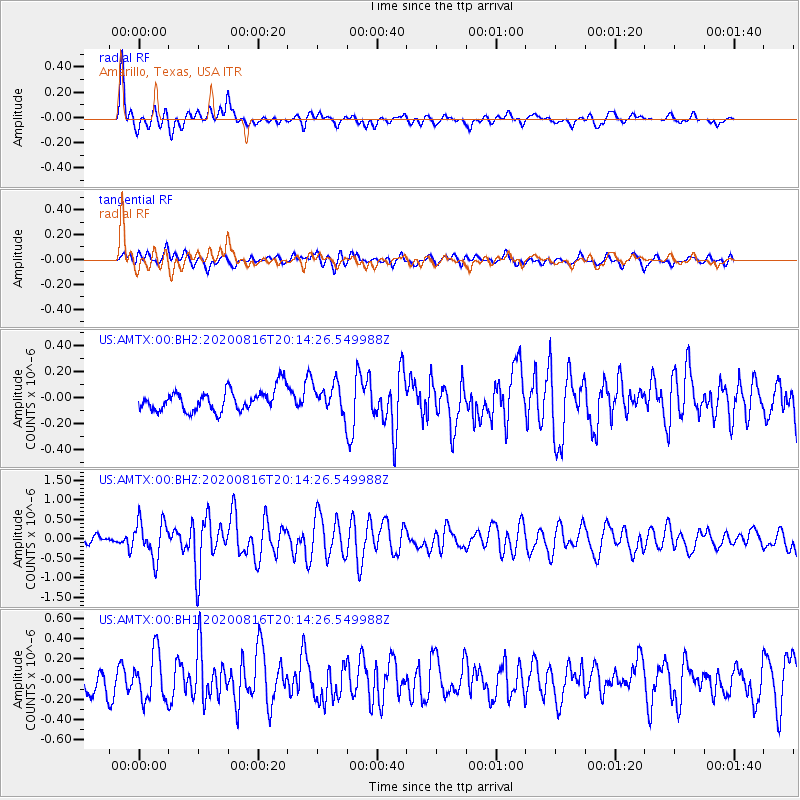
AMTX Amarillo, Texas, USA - Earthquake Result Viewer
*The percent match for this event was below the threshold and hence no stack was calculated.
| Earthquake location: |
Fox Islands, Aleutian Islands |
| Earthquake latitude/longitude: |
51.7/-171.2 |
| Earthquake time(UTC): |
2020/08/16 (229) 20:05:57 GMT |
| Earthquake Depth: |
43 km |
| Earthquake Magnitude: |
5.7 Mi |
| Earthquake Catalog/Contributor: |
NEIC PDE/at |
|
| Network: |
US United States National Seismic Network |
| Station: |
AMTX Amarillo, Texas, USA |
| Lat/Lon: |
34.53 N/101.41 W |
| Elevation: |
1010 m |
|
| Distance: |
51.7 deg |
| Az: |
80.621 deg |
| Baz: |
311.935 deg |
| Ray Param: |
$rayparam |
*The percent match for this event was below the threshold and hence was not used in the summary stack. |
|
| Radial Match: |
70.85502 % |
| Radial Bump: |
400 |
| Transverse Match: |
61.72185 % |
| Transverse Bump: |
400 |
| SOD ConfigId: |
21709731 |
| Insert Time: |
2020-08-30 20:29:01.850 +0000 |
| GWidth: |
2.5 |
| Max Bumps: |
400 |
| Tol: |
0.001 |
|
Signal To Noise
| Channel | StoN | STA | LTA |
| US:AMTX:00:BHZ:20200816T20:14:26.549988Z | 3.979938 | 4.770383E-7 | 1.1986074E-7 |
| US:AMTX:00:BH1:20200816T20:14:26.549988Z | 2.2313664 | 2.4126973E-7 | 1.0812645E-7 |
| US:AMTX:00:BH2:20200816T20:14:26.549988Z | 2.4969332 | 2.0569158E-7 | 8.237769E-8 |
| Arrivals |
| Ps | |
| PpPs | |
| PsPs/PpSs | |


