You are here: Home > Network List > UW - Pacific Northwest Regional Seismic Network Stations List
> Station UMAT Pilot Rock, OR, USA > Earthquake Result Viewer
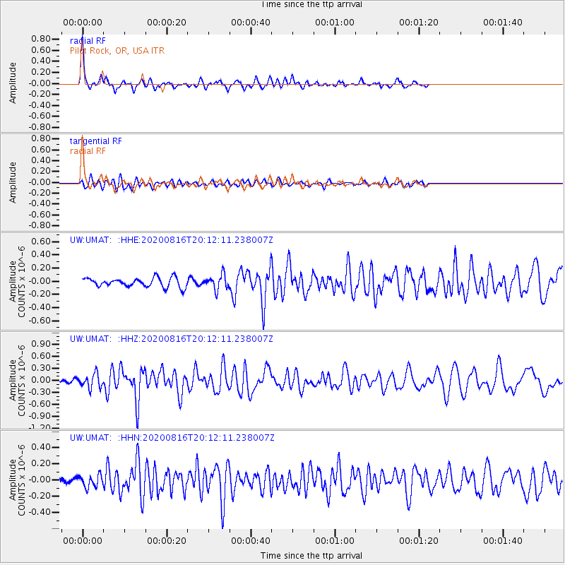
UMAT Pilot Rock, OR, USA - Earthquake Result Viewer
*The percent match for this event was below the threshold and hence no stack was calculated.
| Earthquake location: |
Fox Islands, Aleutian Islands |
| Earthquake latitude/longitude: |
51.7/-171.2 |
| Earthquake time(UTC): |
2020/08/16 (229) 20:05:57 GMT |
| Earthquake Depth: |
43 km |
| Earthquake Magnitude: |
5.7 Mi |
| Earthquake Catalog/Contributor: |
NEIC PDE/at |
|
| Network: |
UW Pacific Northwest Regional Seismic Network |
| Station: |
UMAT Pilot Rock, OR, USA |
| Lat/Lon: |
45.29 N/118.96 W |
| Elevation: |
1318 m |
|
| Distance: |
34.6 deg |
| Az: |
79.584 deg |
| Baz: |
299.852 deg |
| Ray Param: |
$rayparam |
*The percent match for this event was below the threshold and hence was not used in the summary stack. |
|
| Radial Match: |
79.73962 % |
| Radial Bump: |
325 |
| Transverse Match: |
72.09629 % |
| Transverse Bump: |
400 |
| SOD ConfigId: |
21709731 |
| Insert Time: |
2020-08-30 20:31:46.250 +0000 |
| GWidth: |
2.5 |
| Max Bumps: |
400 |
| Tol: |
0.001 |
|
Signal To Noise
| Channel | StoN | STA | LTA |
| UW:UMAT: :HHZ:20200816T20:12:11.238007Z | 2.1671014 | 1.7881474E-7 | 8.251333E-8 |
| UW:UMAT: :HHN:20200816T20:12:11.238007Z | 1.672594 | 7.390948E-8 | 4.418854E-8 |
| UW:UMAT: :HHE:20200816T20:12:11.238007Z | 1.681783 | 1.15061E-7 | 6.841608E-8 |
| Arrivals |
| Ps | |
| PpPs | |
| PsPs/PpSs | |


