You are here: Home > Network List > GS - US Geological Survey Networks Stations List
> Station OK051 E0350 and S34600 Roads, Ralston, OK > Earthquake Result Viewer
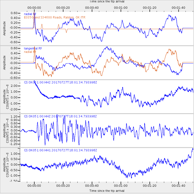
OK051 E0350 and S34600 Roads, Ralston, OK - Earthquake Result Viewer
*The percent match for this event was below the threshold and hence no stack was calculated.
| Earthquake location: |
North Atlantic Ocean |
| Earthquake latitude/longitude: |
13.4/-49.4 |
| Earthquake time(UTC): |
2017/07/27 (208) 17:53:25 GMT |
| Earthquake Depth: |
10 km |
| Earthquake Magnitude: |
5.9 Mww |
| Earthquake Catalog/Contributor: |
NEIC PDE/us |
|
| Network: |
GS US Geological Survey Networks |
| Station: |
OK051 E0350 and S34600 Roads, Ralston, OK |
| Lat/Lon: |
36.51 N/96.84 W |
| Elevation: |
263 m |
|
| Distance: |
48.2 deg |
| Az: |
307.232 deg |
| Baz: |
105.908 deg |
| Ray Param: |
$rayparam |
*The percent match for this event was below the threshold and hence was not used in the summary stack. |
|
| Radial Match: |
18.943552 % |
| Radial Bump: |
400 |
| Transverse Match: |
26.773407 % |
| Transverse Bump: |
400 |
| SOD ConfigId: |
2140511 |
| Insert Time: |
2017-08-10 09:46:37.929 +0000 |
| GWidth: |
2.5 |
| Max Bumps: |
400 |
| Tol: |
0.001 |
|
Signal To Noise
| Channel | StoN | STA | LTA |
| GS:OK051:00:HHZ:20170727T18:01:34.793998Z | 8.177238 | 4.3626136E-7 | 5.3350696E-8 |
| GS:OK051:00:HH1:20170727T18:01:34.793998Z | 1.9079245 | 6.273386E-7 | 3.288068E-7 |
| GS:OK051:00:HH2:20170727T18:01:34.793998Z | 1.0002768 | 6.9866553E-7 | 6.984722E-7 |
| Arrivals |
| Ps | |
| PpPs | |
| PsPs/PpSs | |


