You are here: Home > Network List > GS - US Geological Survey Networks Stations List
> Station MT01 Lincoln Ranger Stn, Helena Natl Forest, Montana, USA > Earthquake Result Viewer
MT01 Lincoln Ranger Stn, Helena Natl Forest, Montana, USA - Earthquake Result Viewer
*The percent match for this event was below the threshold and hence no stack was calculated.
| Earthquake location: |
North Atlantic Ocean |
| Earthquake latitude/longitude: |
13.4/-49.4 |
| Earthquake time(UTC): |
2017/07/27 (208) 17:53:25 GMT |
| Earthquake Depth: |
10 km |
| Earthquake Magnitude: |
5.9 Mww |
| Earthquake Catalog/Contributor: |
NEIC PDE/us |
|
| Network: |
GS US Geological Survey Networks |
| Station: |
MT01 Lincoln Ranger Stn, Helena Natl Forest, Montana, USA |
| Lat/Lon: |
46.95 N/112.66 W |
| Elevation: |
1318 m |
|
| Distance: |
62.1 deg |
| Az: |
316.202 deg |
| Baz: |
100.502 deg |
| Ray Param: |
$rayparam |
*The percent match for this event was below the threshold and hence was not used in the summary stack. |
|
| Radial Match: |
78.19058 % |
| Radial Bump: |
400 |
| Transverse Match: |
72.42438 % |
| Transverse Bump: |
400 |
| SOD ConfigId: |
2140511 |
| Insert Time: |
2017-08-10 09:46:48.547 +0000 |
| GWidth: |
2.5 |
| Max Bumps: |
400 |
| Tol: |
0.001 |
|
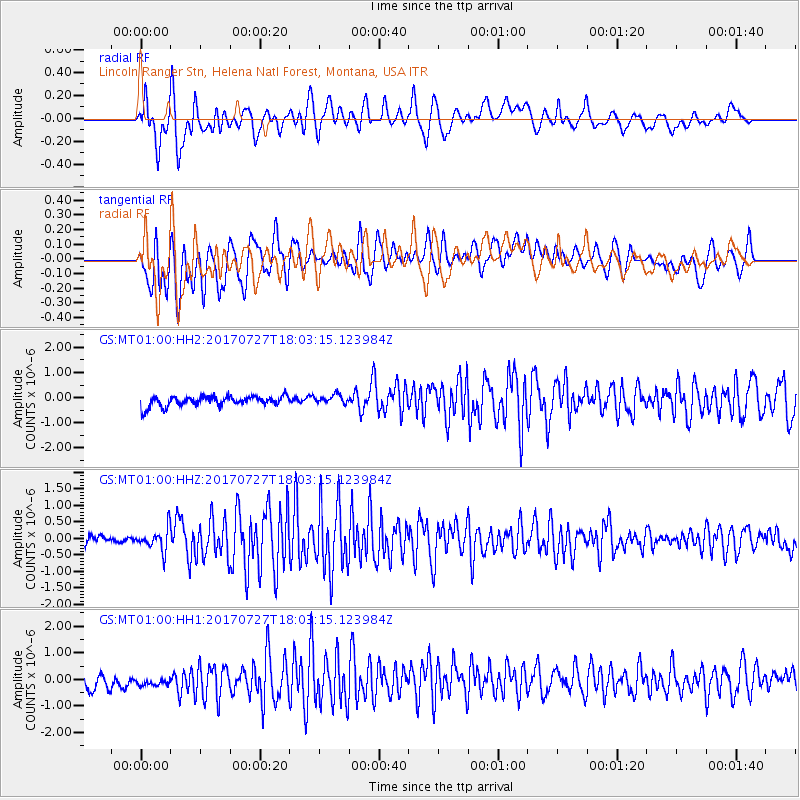
Signal To Noise
| Channel | StoN | STA | LTA |
| GS:MT01:00:HHZ:20170727T18:03:15.123984Z | 2.6067345 | 3.4107492E-7 | 1.3084376E-7 |
| GS:MT01:00:HH1:20170727T18:03:15.123984Z | 0.9012029 | 2.9733923E-7 | 3.2993594E-7 |
| GS:MT01:00:HH2:20170727T18:03:15.123984Z | 0.902461 | 1.8118253E-7 | 2.0076494E-7 |
| Arrivals |
| Ps | |
| PpPs | |
| PsPs/PpSs | |


