You are here: Home > Network List > US - United States National Seismic Network Stations List
> Station EGMT Eagleton, Montana, USA > Earthquake Result Viewer
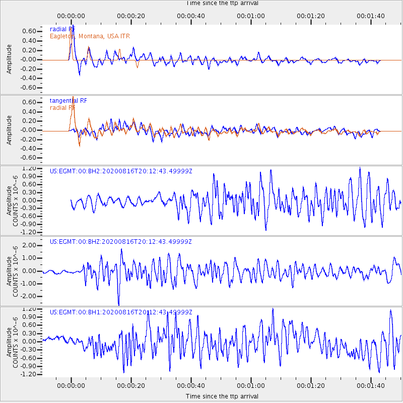
EGMT Eagleton, Montana, USA - Earthquake Result Viewer
*The percent match for this event was below the threshold and hence no stack was calculated.
| Earthquake location: |
Fox Islands, Aleutian Islands |
| Earthquake latitude/longitude: |
51.1/-171.1 |
| Earthquake time(UTC): |
2020/08/16 (229) 20:05:48 GMT |
| Earthquake Depth: |
10 km |
| Earthquake Magnitude: |
5.7 Mww |
| Earthquake Catalog/Contributor: |
NEIC PDE/us |
|
| Network: |
US United States National Seismic Network |
| Station: |
EGMT Eagleton, Montana, USA |
| Lat/Lon: |
48.02 N/109.75 W |
| Elevation: |
1055 m |
|
| Distance: |
38.9 deg |
| Az: |
69.725 deg |
| Baz: |
298.232 deg |
| Ray Param: |
$rayparam |
*The percent match for this event was below the threshold and hence was not used in the summary stack. |
|
| Radial Match: |
78.522675 % |
| Radial Bump: |
400 |
| Transverse Match: |
50.621902 % |
| Transverse Bump: |
400 |
| SOD ConfigId: |
21709731 |
| Insert Time: |
2020-08-30 20:51:46.564 +0000 |
| GWidth: |
2.5 |
| Max Bumps: |
400 |
| Tol: |
0.001 |
|
Signal To Noise
| Channel | StoN | STA | LTA |
| US:EGMT:00:BHZ:20200816T20:12:43.49999Z | 3.1326895 | 2.4545807E-7 | 7.8353786E-8 |
| US:EGMT:00:BH1:20200816T20:12:43.49999Z | 1.6305906 | 1.5783561E-7 | 9.67966E-8 |
| US:EGMT:00:BH2:20200816T20:12:43.49999Z | 1.2863938 | 1.9677177E-7 | 1.5296386E-7 |
| Arrivals |
| Ps | |
| PpPs | |
| PsPs/PpSs | |


