You are here: Home > Network List > GS - US Geological Survey Networks Stations List
> Station DEC06 Boomer > Earthquake Result Viewer
DEC06 Boomer - Earthquake Result Viewer
*The percent match for this event was below the threshold and hence no stack was calculated.
| Earthquake location: |
Southern Mid-Atlantic Ridge |
| Earthquake latitude/longitude: |
-17.6/-12.9 |
| Earthquake time(UTC): |
2020/08/17 (230) 11:45:39 GMT |
| Earthquake Depth: |
10 km |
| Earthquake Magnitude: |
5.5 Mww |
| Earthquake Catalog/Contributor: |
NEIC PDE/us |
|
| Network: |
GS US Geological Survey Networks |
| Station: |
DEC06 Boomer |
| Lat/Lon: |
39.90 N/88.95 W |
| Elevation: |
215 m |
|
| Distance: |
90.8 deg |
| Az: |
311.708 deg |
| Baz: |
112.219 deg |
| Ray Param: |
$rayparam |
*The percent match for this event was below the threshold and hence was not used in the summary stack. |
|
| Radial Match: |
33.52553 % |
| Radial Bump: |
400 |
| Transverse Match: |
37.333805 % |
| Transverse Bump: |
400 |
| SOD ConfigId: |
21709731 |
| Insert Time: |
2020-08-31 11:49:44.434 +0000 |
| GWidth: |
2.5 |
| Max Bumps: |
400 |
| Tol: |
0.001 |
|
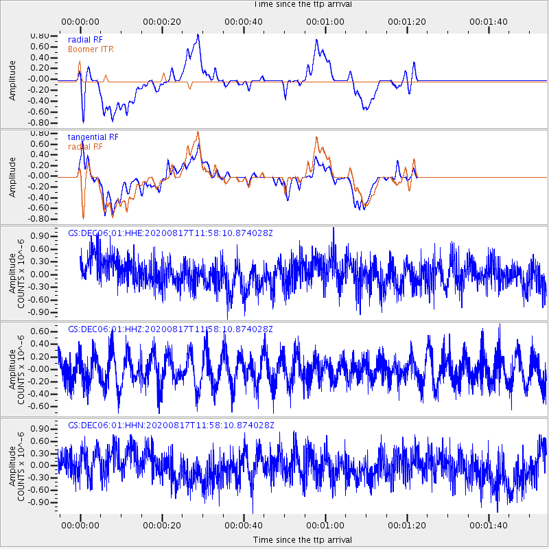
Signal To Noise
| Channel | StoN | STA | LTA |
| GS:DEC06:01:HHZ:20200817T11:58:10.874028Z | 1.0695032 | 2.2114489E-7 | 2.0677348E-7 |
| GS:DEC06:01:HHN:20200817T11:58:10.874028Z | 1.0248749 | 4.7248616E-7 | 4.6101835E-7 |
| GS:DEC06:01:HHE:20200817T11:58:10.874028Z | 0.9742923 | 2.9969118E-7 | 3.0759884E-7 |
| Arrivals |
| Ps | |
| PpPs | |
| PsPs/PpSs | |


