You are here: Home > Network List > AV - Alaska Volcano Observatory Stations List
> Station PLBL Mt. Peulik Volcano, Alaska > Earthquake Result Viewer
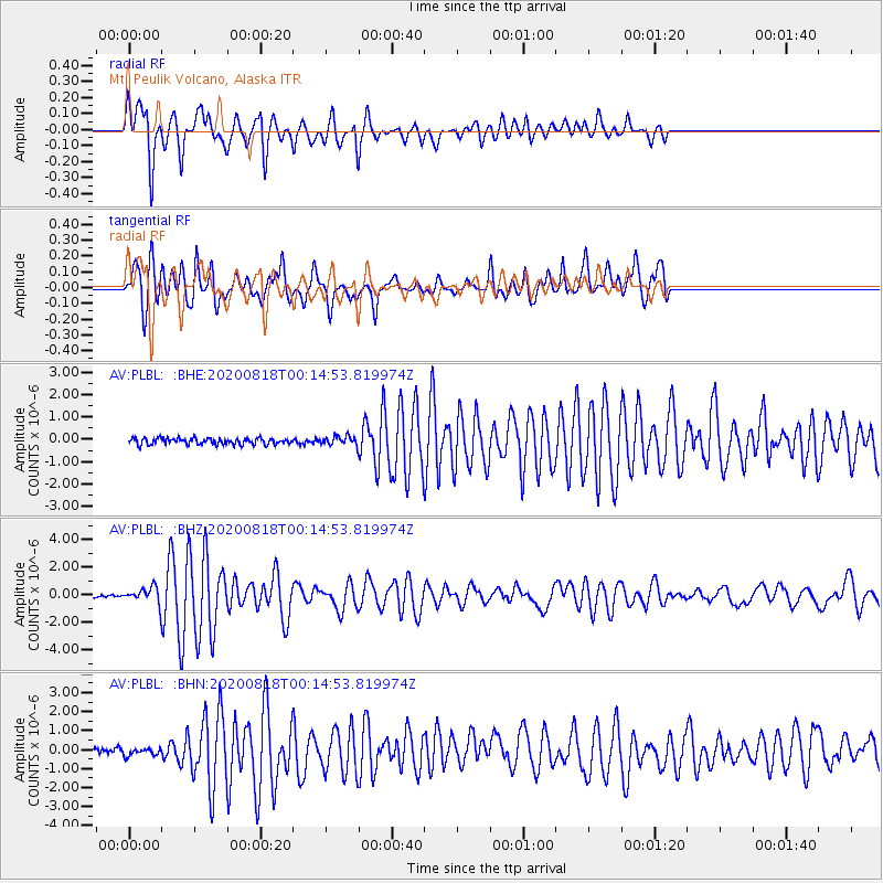
PLBL Mt. Peulik Volcano, Alaska - Earthquake Result Viewer
*The percent match for this event was below the threshold and hence no stack was calculated.
| Earthquake location: |
Samar, Philippines |
| Earthquake latitude/longitude: |
12.0/124.1 |
| Earthquake time(UTC): |
2020/08/18 (231) 00:03:48 GMT |
| Earthquake Depth: |
10 km |
| Earthquake Magnitude: |
6.7 mww |
| Earthquake Catalog/Contributor: |
NEIC PDE/us |
|
| Network: |
AV Alaska Volcano Observatory |
| Station: |
PLBL Mt. Peulik Volcano, Alaska |
| Lat/Lon: |
57.70 N/156.82 W |
| Elevation: |
461 m |
|
| Distance: |
74.1 deg |
| Az: |
33.242 deg |
| Baz: |
267.291 deg |
| Ray Param: |
$rayparam |
*The percent match for this event was below the threshold and hence was not used in the summary stack. |
|
| Radial Match: |
85.92563 % |
| Radial Bump: |
376 |
| Transverse Match: |
75.75123 % |
| Transverse Bump: |
388 |
| SOD ConfigId: |
21709731 |
| Insert Time: |
2020-09-01 00:09:29.508 +0000 |
| GWidth: |
2.5 |
| Max Bumps: |
400 |
| Tol: |
0.001 |
|
Signal To Noise
| Channel | StoN | STA | LTA |
| AV:PLBL: :BHZ:20200818T00:14:53.819974Z | 6.363839 | 5.334099E-7 | 8.381888E-8 |
| AV:PLBL: :BHN:20200818T00:14:53.819974Z | 1.1478858 | 2.0449461E-7 | 1.7814891E-7 |
| AV:PLBL: :BHE:20200818T00:14:53.819974Z | 1.3849066 | 1.9181029E-7 | 1.3850051E-7 |
| Arrivals |
| Ps | |
| PpPs | |
| PsPs/PpSs | |


