You are here: Home > Network List > US - United States National Seismic Network Stations List
> Station BW06 Boulder Array Site 6 (Pinedale), Wyoming, USA > Earthquake Result Viewer
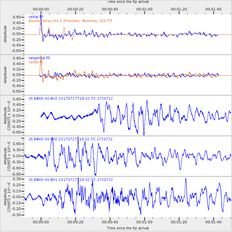
BW06 Boulder Array Site 6 (Pinedale), Wyoming, USA - Earthquake Result Viewer
*The percent match for this event was below the threshold and hence no stack was calculated.
| Earthquake location: |
North Atlantic Ocean |
| Earthquake latitude/longitude: |
13.4/-49.4 |
| Earthquake time(UTC): |
2017/07/27 (208) 17:53:25 GMT |
| Earthquake Depth: |
10 km |
| Earthquake Magnitude: |
5.9 Mww |
| Earthquake Catalog/Contributor: |
NEIC PDE/us |
|
| Network: |
US United States National Seismic Network |
| Station: |
BW06 Boulder Array Site 6 (Pinedale), Wyoming, USA |
| Lat/Lon: |
42.77 N/109.56 W |
| Elevation: |
2224 m |
|
| Distance: |
59.2 deg |
| Az: |
311.947 deg |
| Baz: |
100.596 deg |
| Ray Param: |
$rayparam |
*The percent match for this event was below the threshold and hence was not used in the summary stack. |
|
| Radial Match: |
79.58006 % |
| Radial Bump: |
400 |
| Transverse Match: |
72.10747 % |
| Transverse Bump: |
400 |
| SOD ConfigId: |
2140511 |
| Insert Time: |
2017-08-10 09:49:25.416 +0000 |
| GWidth: |
2.5 |
| Max Bumps: |
400 |
| Tol: |
0.001 |
|
Signal To Noise
| Channel | StoN | STA | LTA |
| US:BW06:00:BHZ:20170727T18:02:55.173972Z | 2.85926 | 1.6989756E-7 | 5.9420113E-8 |
| US:BW06:00:BH1:20170727T18:02:55.173972Z | 1.8922738 | 6.3796186E-8 | 3.3714038E-8 |
| US:BW06:00:BH2:20170727T18:02:55.173972Z | 3.5467787 | 2.2840705E-7 | 6.439845E-8 |
| Arrivals |
| Ps | |
| PpPs | |
| PsPs/PpSs | |


