You are here: Home > Network List > US - United States National Seismic Network Stations List
> Station DGMT Dagmar, Montana, USA > Earthquake Result Viewer
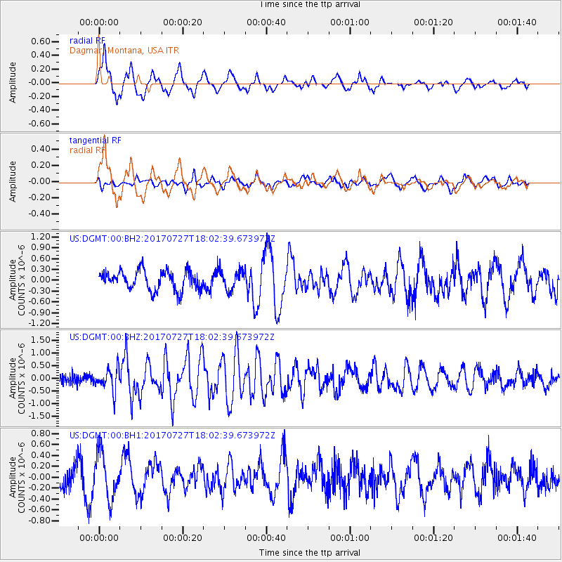
DGMT Dagmar, Montana, USA - Earthquake Result Viewer
*The percent match for this event was below the threshold and hence no stack was calculated.
| Earthquake location: |
North Atlantic Ocean |
| Earthquake latitude/longitude: |
13.4/-49.4 |
| Earthquake time(UTC): |
2017/07/27 (208) 17:53:25 GMT |
| Earthquake Depth: |
10 km |
| Earthquake Magnitude: |
5.9 Mww |
| Earthquake Catalog/Contributor: |
NEIC PDE/us |
|
| Network: |
US United States National Seismic Network |
| Station: |
DGMT Dagmar, Montana, USA |
| Lat/Lon: |
48.47 N/104.20 W |
| Elevation: |
0.0 m |
|
| Distance: |
57.0 deg |
| Az: |
319.558 deg |
| Baz: |
108.45 deg |
| Ray Param: |
$rayparam |
*The percent match for this event was below the threshold and hence was not used in the summary stack. |
|
| Radial Match: |
78.89594 % |
| Radial Bump: |
400 |
| Transverse Match: |
52.202698 % |
| Transverse Bump: |
400 |
| SOD ConfigId: |
2140511 |
| Insert Time: |
2017-08-10 09:49:30.645 +0000 |
| GWidth: |
2.5 |
| Max Bumps: |
400 |
| Tol: |
0.001 |
|
Signal To Noise
| Channel | StoN | STA | LTA |
| US:DGMT:00:BHZ:20170727T18:02:39.673972Z | 3.740824 | 4.5667784E-7 | 1.2207948E-7 |
| US:DGMT:00:BH1:20170727T18:02:39.673972Z | 2.3836741 | 4.25347E-7 | 1.7844175E-7 |
| US:DGMT:00:BH2:20170727T18:02:39.673972Z | 0.9902972 | 2.5775873E-7 | 2.6028422E-7 |
| Arrivals |
| Ps | |
| PpPs | |
| PsPs/PpSs | |


