You are here: Home > Network List > TA - USArray Transportable Network (new EarthScope stations) Stations List
> Station G21K Allakaket, AK, USA > Earthquake Result Viewer
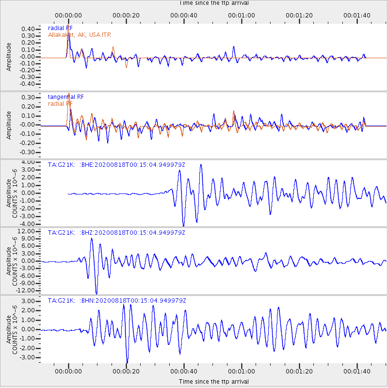
G21K Allakaket, AK, USA - Earthquake Result Viewer
*The percent match for this event was below the threshold and hence no stack was calculated.
| Earthquake location: |
Samar, Philippines |
| Earthquake latitude/longitude: |
12.0/124.1 |
| Earthquake time(UTC): |
2020/08/18 (231) 00:03:48 GMT |
| Earthquake Depth: |
10 km |
| Earthquake Magnitude: |
6.7 mww |
| Earthquake Catalog/Contributor: |
NEIC PDE/us |
|
| Network: |
TA USArray Transportable Network (new EarthScope stations) |
| Station: |
G21K Allakaket, AK, USA |
| Lat/Lon: |
66.52 N/153.51 W |
| Elevation: |
446 m |
|
| Distance: |
76.0 deg |
| Az: |
24.162 deg |
| Baz: |
267.88 deg |
| Ray Param: |
$rayparam |
*The percent match for this event was below the threshold and hence was not used in the summary stack. |
|
| Radial Match: |
95.50276 % |
| Radial Bump: |
400 |
| Transverse Match: |
92.31668 % |
| Transverse Bump: |
400 |
| SOD ConfigId: |
21709731 |
| Insert Time: |
2020-09-01 00:16:34.179 +0000 |
| GWidth: |
2.5 |
| Max Bumps: |
400 |
| Tol: |
0.001 |
|
Signal To Noise
| Channel | StoN | STA | LTA |
| TA:G21K: :BHZ:20200818T00:15:04.949979Z | 6.562174 | 4.8822466E-7 | 7.4399836E-8 |
| TA:G21K: :BHN:20200818T00:15:04.949979Z | 1.7622218 | 7.4563445E-8 | 4.2312177E-8 |
| TA:G21K: :BHE:20200818T00:15:04.949979Z | 3.5667865 | 1.5206727E-7 | 4.263425E-8 |
| Arrivals |
| Ps | |
| PpPs | |
| PsPs/PpSs | |


