You are here: Home > Network List > US - United States National Seismic Network Stations List
> Station HAWA Hanford, Washington, USA > Earthquake Result Viewer
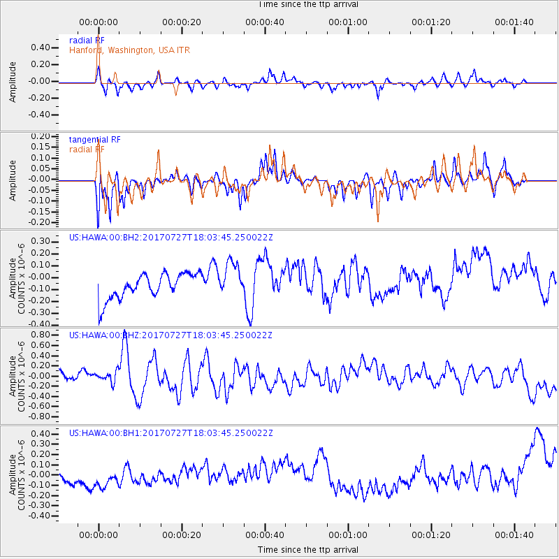
HAWA Hanford, Washington, USA - Earthquake Result Viewer
*The percent match for this event was below the threshold and hence no stack was calculated.
| Earthquake location: |
North Atlantic Ocean |
| Earthquake latitude/longitude: |
13.4/-49.4 |
| Earthquake time(UTC): |
2017/07/27 (208) 17:53:25 GMT |
| Earthquake Depth: |
10 km |
| Earthquake Magnitude: |
5.9 Mww |
| Earthquake Catalog/Contributor: |
NEIC PDE/us |
|
| Network: |
US United States National Seismic Network |
| Station: |
HAWA Hanford, Washington, USA |
| Lat/Lon: |
46.39 N/119.53 W |
| Elevation: |
364 m |
|
| Distance: |
66.8 deg |
| Az: |
314.883 deg |
| Baz: |
94.943 deg |
| Ray Param: |
$rayparam |
*The percent match for this event was below the threshold and hence was not used in the summary stack. |
|
| Radial Match: |
55.935726 % |
| Radial Bump: |
356 |
| Transverse Match: |
67.15318 % |
| Transverse Bump: |
340 |
| SOD ConfigId: |
2140511 |
| Insert Time: |
2017-08-10 09:49:43.501 +0000 |
| GWidth: |
2.5 |
| Max Bumps: |
400 |
| Tol: |
0.001 |
|
Signal To Noise
| Channel | StoN | STA | LTA |
| US:HAWA:00:BHZ:20170727T18:03:45.250022Z | 1.2374431 | 1.4482683E-7 | 1.1703716E-7 |
| US:HAWA:00:BH1:20170727T18:03:45.250022Z | 1.1415442 | 1.9267144E-7 | 1.6878141E-7 |
| US:HAWA:00:BH2:20170727T18:03:45.250022Z | 1.3958228 | 1.4850428E-7 | 1.0639193E-7 |
| Arrivals |
| Ps | |
| PpPs | |
| PsPs/PpSs | |


