You are here: Home > Network List > TA - USArray Transportable Network (new EarthScope stations) Stations List
> Station C16K Lisburne Hills, AK, USA > Earthquake Result Viewer
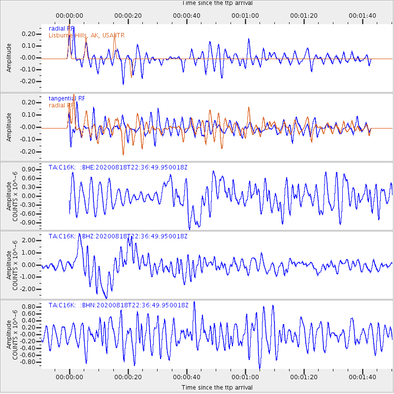
C16K Lisburne Hills, AK, USA - Earthquake Result Viewer
*The percent match for this event was below the threshold and hence no stack was calculated.
| Earthquake location: |
Southern Sumatra, Indonesia |
| Earthquake latitude/longitude: |
-4.4/101.1 |
| Earthquake time(UTC): |
2020/08/18 (231) 22:23:57 GMT |
| Earthquake Depth: |
10 km |
| Earthquake Magnitude: |
6.8 mww |
| Earthquake Catalog/Contributor: |
NEIC PDE/us |
|
| Network: |
TA USArray Transportable Network (new EarthScope stations) |
| Station: |
C16K Lisburne Hills, AK, USA |
| Lat/Lon: |
68.27 N/165.34 W |
| Elevation: |
102 m |
|
| Distance: |
95.4 deg |
| Az: |
21.914 deg |
| Baz: |
271.686 deg |
| Ray Param: |
$rayparam |
*The percent match for this event was below the threshold and hence was not used in the summary stack. |
|
| Radial Match: |
64.16827 % |
| Radial Bump: |
400 |
| Transverse Match: |
61.212017 % |
| Transverse Bump: |
400 |
| SOD ConfigId: |
21709731 |
| Insert Time: |
2020-09-01 22:33:31.986 +0000 |
| GWidth: |
2.5 |
| Max Bumps: |
400 |
| Tol: |
0.001 |
|
Signal To Noise
| Channel | StoN | STA | LTA |
| TA:C16K: :BHZ:20200818T22:36:49.950018Z | 8.072141 | 1.1937973E-6 | 1.4789103E-7 |
| TA:C16K: :BHN:20200818T22:36:49.950018Z | 1.1121577 | 2.2988102E-7 | 2.0669823E-7 |
| TA:C16K: :BHE:20200818T22:36:49.950018Z | 1.1207302 | 3.997798E-7 | 3.567137E-7 |
| Arrivals |
| Ps | |
| PpPs | |
| PsPs/PpSs | |


