You are here: Home > Network List > AV - Alaska Volcano Observatory Stations List
> Station AMKA Regional Station, Amchitka Island, Alaska > Earthquake Result Viewer
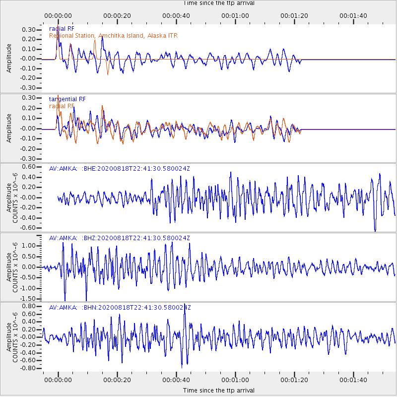
AMKA Regional Station, Amchitka Island, Alaska - Earthquake Result Viewer
*The percent match for this event was below the threshold and hence no stack was calculated.
| Earthquake location: |
Southern Sumatra, Indonesia |
| Earthquake latitude/longitude: |
-4.3/101.2 |
| Earthquake time(UTC): |
2020/08/18 (231) 22:29:22 GMT |
| Earthquake Depth: |
10 km |
| Earthquake Magnitude: |
6.9 mww |
| Earthquake Catalog/Contributor: |
NEIC PDE/us |
|
| Network: |
AV Alaska Volcano Observatory |
| Station: |
AMKA Regional Station, Amchitka Island, Alaska |
| Lat/Lon: |
51.38 N/179.30 E |
| Elevation: |
116 m |
|
| Distance: |
85.9 deg |
| Az: |
37.937 deg |
| Baz: |
258.03 deg |
| Ray Param: |
$rayparam |
*The percent match for this event was below the threshold and hence was not used in the summary stack. |
|
| Radial Match: |
79.90567 % |
| Radial Bump: |
400 |
| Transverse Match: |
75.39636 % |
| Transverse Bump: |
400 |
| SOD ConfigId: |
21709731 |
| Insert Time: |
2020-09-01 22:36:14.727 +0000 |
| GWidth: |
2.5 |
| Max Bumps: |
400 |
| Tol: |
0.001 |
|
Signal To Noise
| Channel | StoN | STA | LTA |
| AV:AMKA: :BHZ:20200818T22:41:30.580024Z | 7.636526 | 5.6219596E-7 | 7.3619326E-8 |
| AV:AMKA: :BHN:20200818T22:41:30.580024Z | 1.5131022 | 1.040545E-7 | 6.876898E-8 |
| AV:AMKA: :BHE:20200818T22:41:30.580024Z | 2.0398629 | 1.5617576E-7 | 7.656188E-8 |
| Arrivals |
| Ps | |
| PpPs | |
| PsPs/PpSs | |


