You are here: Home > Network List > TA - USArray Transportable Network (new EarthScope stations) Stations List
> Station B18K Kokolik River, AK, USA > Earthquake Result Viewer
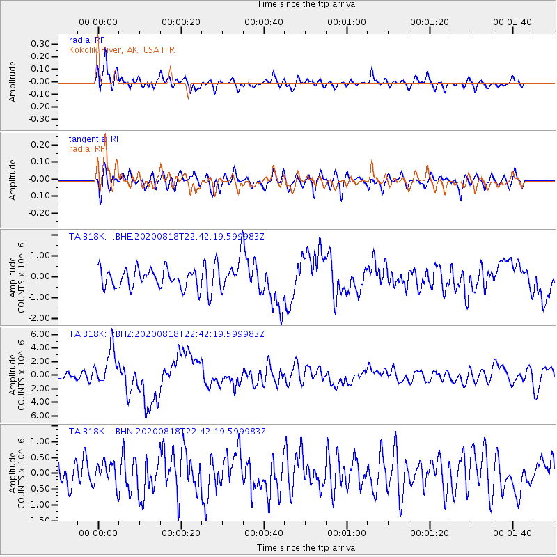
B18K Kokolik River, AK, USA - Earthquake Result Viewer
*The percent match for this event was below the threshold and hence no stack was calculated.
| Earthquake location: |
Southern Sumatra, Indonesia |
| Earthquake latitude/longitude: |
-4.3/101.2 |
| Earthquake time(UTC): |
2020/08/18 (231) 22:29:22 GMT |
| Earthquake Depth: |
10 km |
| Earthquake Magnitude: |
6.9 mww |
| Earthquake Catalog/Contributor: |
NEIC PDE/us |
|
| Network: |
TA USArray Transportable Network (new EarthScope stations) |
| Station: |
B18K Kokolik River, AK, USA |
| Lat/Lon: |
69.36 N/161.80 W |
| Elevation: |
222 m |
|
| Distance: |
96.4 deg |
| Az: |
20.739 deg |
| Baz: |
275.028 deg |
| Ray Param: |
$rayparam |
*The percent match for this event was below the threshold and hence was not used in the summary stack. |
|
| Radial Match: |
78.03064 % |
| Radial Bump: |
400 |
| Transverse Match: |
61.670166 % |
| Transverse Bump: |
400 |
| SOD ConfigId: |
21709731 |
| Insert Time: |
2020-09-01 22:41:53.720 +0000 |
| GWidth: |
2.5 |
| Max Bumps: |
400 |
| Tol: |
0.001 |
|
Signal To Noise
| Channel | StoN | STA | LTA |
| TA:B18K: :BHZ:20200818T22:42:19.599983Z | 5.110917 | 2.8091756E-6 | 5.4964215E-7 |
| TA:B18K: :BHN:20200818T22:42:19.599983Z | 1.03958 | 3.5967923E-7 | 3.4598514E-7 |
| TA:B18K: :BHE:20200818T22:42:19.599983Z | 1.775942 | 7.574316E-7 | 4.264957E-7 |
| Arrivals |
| Ps | |
| PpPs | |
| PsPs/PpSs | |


