You are here: Home > Network List > IU - Global Seismograph Network (GSN - IRIS/USGS) Stations List
> Station CCM Cathedral Cave, Missouri, USA > Earthquake Result Viewer
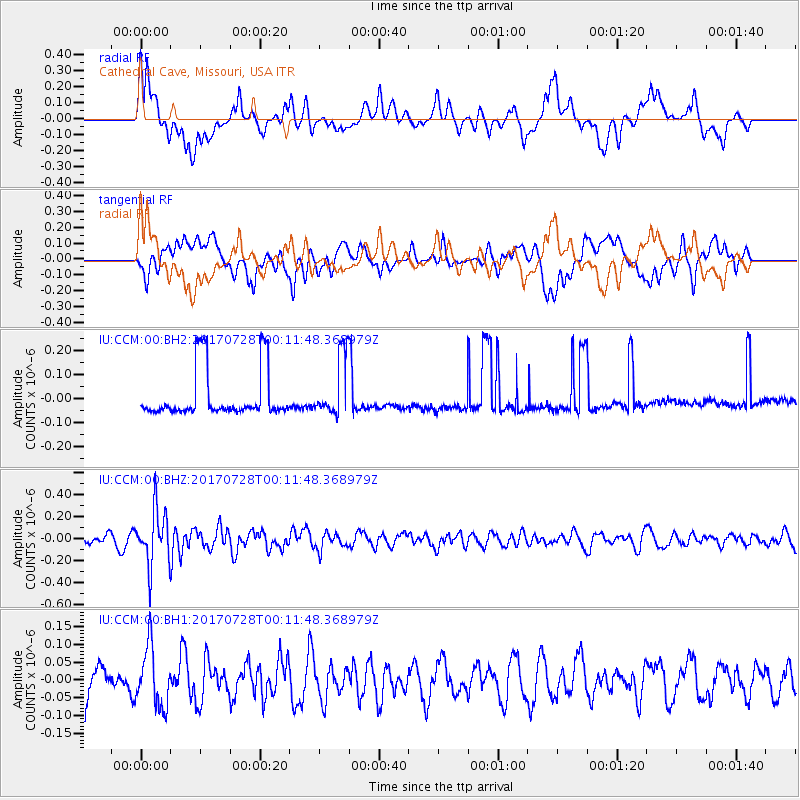
CCM Cathedral Cave, Missouri, USA - Earthquake Result Viewer
*The percent match for this event was below the threshold and hence no stack was calculated.
| Earthquake location: |
Southeast Of Honshu, Japan |
| Earthquake latitude/longitude: |
29.3/143.0 |
| Earthquake time(UTC): |
2017/07/27 (208) 23:58:52 GMT |
| Earthquake Depth: |
10 km |
| Earthquake Magnitude: |
5.3 Mww |
| Earthquake Catalog/Contributor: |
NEIC PDE/us |
|
| Network: |
IU Global Seismograph Network (GSN - IRIS/USGS) |
| Station: |
CCM Cathedral Cave, Missouri, USA |
| Lat/Lon: |
38.06 N/91.24 W |
| Elevation: |
222 m |
|
| Distance: |
96.0 deg |
| Az: |
40.077 deg |
| Baz: |
314.56 deg |
| Ray Param: |
$rayparam |
*The percent match for this event was below the threshold and hence was not used in the summary stack. |
|
| Radial Match: |
47.509693 % |
| Radial Bump: |
400 |
| Transverse Match: |
52.91589 % |
| Transverse Bump: |
400 |
| SOD ConfigId: |
2140511 |
| Insert Time: |
2017-08-10 15:58:18.321 +0000 |
| GWidth: |
2.5 |
| Max Bumps: |
400 |
| Tol: |
0.001 |
|
Signal To Noise
| Channel | StoN | STA | LTA |
| IU:CCM:00:BHZ:20170728T00:11:48.368979Z | 5.3535852 | 2.497108E-7 | 4.6643663E-8 |
| IU:CCM:00:BH1:20170728T00:11:48.368979Z | 1.9720924 | 8.4196174E-8 | 4.2693827E-8 |
| IU:CCM:00:BH2:20170728T00:11:48.368979Z | 1.2723398 | 1.2642666E-7 | 9.936548E-8 |
| Arrivals |
| Ps | |
| PpPs | |
| PsPs/PpSs | |


