You are here: Home > Network List > G - GEOSCOPE Stations List
> Station INU Inuyama, Japan > Earthquake Result Viewer
INU Inuyama, Japan - Earthquake Result Viewer
*The percent match for this event was below the threshold and hence no stack was calculated.
| Earthquake location: |
Southwest Of Sumatra, Indonesia |
| Earthquake latitude/longitude: |
-4.1/101.0 |
| Earthquake time(UTC): |
2020/08/22 (235) 00:39:33 GMT |
| Earthquake Depth: |
10 km |
| Earthquake Magnitude: |
5.4 Mww |
| Earthquake Catalog/Contributor: |
NEIC PDE/us |
|
| Network: |
G GEOSCOPE |
| Station: |
INU Inuyama, Japan |
| Lat/Lon: |
35.35 N/137.03 E |
| Elevation: |
132 m |
|
| Distance: |
51.8 deg |
| Az: |
37.746 deg |
| Baz: |
228.33 deg |
| Ray Param: |
$rayparam |
*The percent match for this event was below the threshold and hence was not used in the summary stack. |
|
| Radial Match: |
74.83541 % |
| Radial Bump: |
400 |
| Transverse Match: |
62.43955 % |
| Transverse Bump: |
400 |
| SOD ConfigId: |
21709731 |
| Insert Time: |
2020-09-05 00:42:06.031 +0000 |
| GWidth: |
2.5 |
| Max Bumps: |
400 |
| Tol: |
0.001 |
|
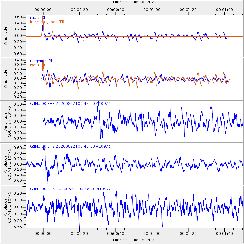
Signal To Noise
| Channel | StoN | STA | LTA |
| G:INU:00:BHZ:20200822T00:48:10.41097Z | 5.556477 | 3.7158253E-7 | 6.687377E-8 |
| G:INU:00:BHN:20200822T00:48:10.41097Z | 1.5487942 | 9.57709E-8 | 6.1835784E-8 |
| G:INU:00:BHE:20200822T00:48:10.41097Z | 3.4915836 | 1.7706917E-7 | 5.0713137E-8 |
| Arrivals |
| Ps | |
| PpPs | |
| PsPs/PpSs | |


