You are here: Home > Network List > IU - Global Seismograph Network (GSN - IRIS/USGS) Stations List
> Station PMG Port Moresby, New Guinea > Earthquake Result Viewer
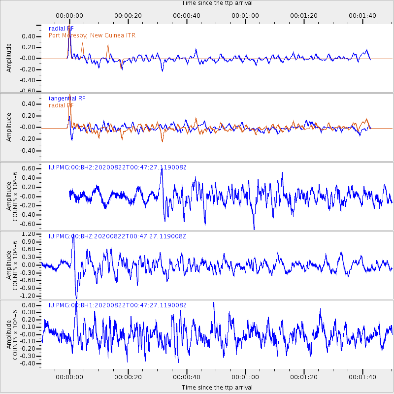
PMG Port Moresby, New Guinea - Earthquake Result Viewer
*The percent match for this event was below the threshold and hence no stack was calculated.
| Earthquake location: |
Southwest Of Sumatra, Indonesia |
| Earthquake latitude/longitude: |
-4.1/101.0 |
| Earthquake time(UTC): |
2020/08/22 (235) 00:39:33 GMT |
| Earthquake Depth: |
10 km |
| Earthquake Magnitude: |
5.4 Mww |
| Earthquake Catalog/Contributor: |
NEIC PDE/us |
|
| Network: |
IU Global Seismograph Network (GSN - IRIS/USGS) |
| Station: |
PMG Port Moresby, New Guinea |
| Lat/Lon: |
9.40 S/147.16 E |
| Elevation: |
90 m |
|
| Distance: |
46.1 deg |
| Az: |
99.083 deg |
| Baz: |
273.392 deg |
| Ray Param: |
$rayparam |
*The percent match for this event was below the threshold and hence was not used in the summary stack. |
|
| Radial Match: |
78.873886 % |
| Radial Bump: |
400 |
| Transverse Match: |
62.224762 % |
| Transverse Bump: |
400 |
| SOD ConfigId: |
21709731 |
| Insert Time: |
2020-09-05 00:43:14.117 +0000 |
| GWidth: |
2.5 |
| Max Bumps: |
400 |
| Tol: |
0.001 |
|
Signal To Noise
| Channel | StoN | STA | LTA |
| IU:PMG:00:BHZ:20200822T00:47:27.119008Z | 9.234706 | 6.271301E-7 | 6.791013E-8 |
| IU:PMG:00:BH1:20200822T00:47:27.119008Z | 1.2619023 | 1.6307783E-7 | 1.2923174E-7 |
| IU:PMG:00:BH2:20200822T00:47:27.119008Z | 2.7771506 | 2.896497E-7 | 1.0429744E-7 |
| Arrivals |
| Ps | |
| PpPs | |
| PsPs/PpSs | |


